Mezcales night lights from space
Night Light of Mezcales (Nayarit) from space (Mexico) Src. Average luminocity for 10x10km area is 54.4564% and for 50x50km: 8.7929%.
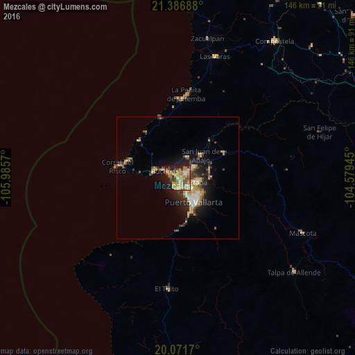
Analysis of Mezcales night lights 2016
Square area 10x10 km:
 1.89%
1.89%90-99
4.55%80-89
15.91%70-79
17.8%60-69
10.61%50-59
6.06%40-49
10.61%30-39
6.63%20-29
10.42%10-19
14.39%0-9
1.14%Square area 50x50 km:
0.64%90-99
0.96%80-89
1.72%70-79
1.83%60-69
1.23%50-59
0.85%40-49
1.48%30-39
1.34%20-29
2.52%10-19
5.6%0-9
81.82%Clear (daylight) street map image can be seen on geolist.org.
Map coordinates:
21° 23' 12.8" North, 105° 59' 8.5" West
20° 43' 50.6" North, 105° 16' 57.3" West
20° 4' 18.1" North, 104° 34' 46" West
Some cities around Mezcales sort by population:
• Ixtapa
8.2 km =5.1 mi,  101°
101°
• San José del Valle
6.7 km =4.2 mi,  57°
57°
• San Vicente
3.9 km =2.4 mi, 59°
• Bucerías
6.1 km =3.8 mi,  297°
297°
• Las Juntas
5 km =3.1 mi,  130°
130°
• Valle de Banderas
9.3 km =5.8 mi,  22°
22°
• Las Jarretaderas
4.3 km =2.7 mi,  168°
168°
• El Porvenir
4.9 km =3 mi, 58°
3996030 (p: 20,092)
Sources (retrieved 2019-11-25):
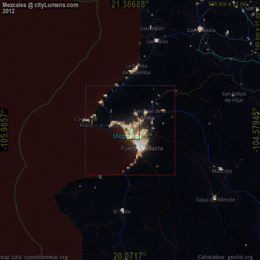
» Earth at Night: Flat Maps 2012, 2016