Playa Vicente night lights from space
Night Light of Playa Vicente (Veracruz) from space (Mexico) Src. Average luminocity for 10x10km area is 6.1364% and for 50x50km: 0.6872%.
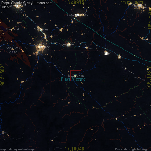
Analysis of Playa Vicente night lights 2016
Square area 10x10 km:
 0%
0%90-99
1.08%80-89
2.6%70-79
0.65%60-69
0%50-59
0.87%40-49
0.22%30-39
1.52%20-29
0.43%10-19
1.73%0-9
90.91%Square area 50x50 km:
0%90-99
0.04%80-89
0.1%70-79
0.06%60-69
0%50-59
0.12%40-49
0.38%30-39
0.27%20-29
0.2%10-19
0.25%0-9
98.59%Clear (daylight) street map image can be seen on geolist.org.
Map coordinates:
18° 29' 56.9" North, 96° 30' 54.1" West
17° 49' 51.9" North, 95° 48' 42.8" West
17° 9' 37.7" North, 95° 6' 31.6" West
Some cities around Playa Vicente sort by population:
• Tuxtepec
43.8 km =27.2 mi,  310°
310°
• Loma Bonita
31.5 km =19.6 mi,  346°
346°
• Isla
37 km =23 mi,  53°
53°
• Tres Valles
56.8 km =35.3 mi,  322°
322°
• Juan Rodríguez Clara
47 km =29.2 mi,  67°
67°
• Tesechoacan
37.7 km =23.4 mi,  25°
25°
• Villa Azueta
29 km =18 mi,  21°
21°
• Valle Nacional
52.2 km =32.4 mi,  263°
263°
3521334 (p: 9,083)
Sources (retrieved 2019-11-25):
» Earth at Night: Flat Maps 2012, 2016