Coatepec night lights from space
Night Light of Coatepec (Veracruz) from space (Mexico) Src. Average luminocity for 10x10km area is 33.3926% and for 50x50km: 10.3787%.
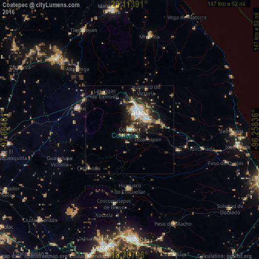
Analysis of Coatepec night lights 2016
Square area 10x10 km:
 1.24%
1.24%90-99
2.07%80-89
6.61%70-79
2.69%60-69
7.85%50-59
4.55%40-49
5.99%30-39
9.09%20-29
16.94%10-19
32.23%0-9
10.74%Square area 50x50 km:
1.38%90-99
1.26%80-89
1.17%70-79
1.16%60-69
1.51%50-59
1.23%40-49
2.01%30-39
2.41%20-29
3.39%10-19
6.34%0-9
78.14%Clear (daylight) street map image can be seen on geolist.org.
Map coordinates:
20° 6' 50.1" North, 97° 39' 52.6" West
19° 27' 8.2" North, 96° 57' 41.3" West
18° 47' 16.7" North, 96° 15' 30.1" West
Some cities around Coatepec sort by population:
• Xalapa de Enríquez
10 km =6.2 mi,  28°
28°
• Xico
6 km =3.7 mi,  235°
235°
• Teocelo
7.5 km =4.7 mi,  189°
189°
• Colonia Santa Bárbara
10.3 km =6.4 mi,  57°
57°
• Tuzamapan
11.7 km =7.3 mi,  118°
118°
• San Marcos de León
3.2 km =2 mi, 185°
• Lomas Verdes
9.6 km =6 mi,  52°
52°
• Guadalupe Victoria
11.4 km =7.1 mi,  0°
0°
3530531 (p: 53,621)
Sources (retrieved 2019-11-25):
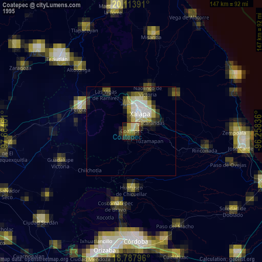
» NASA, Earths city lights 1995
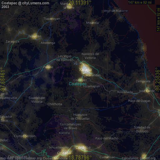
» NASA city lights 2003
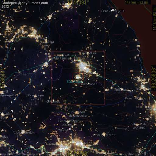
» Earth at Night: Flat Maps 2012, 2016