Pajacuarán night lights from space
Night Light of Pajacuarán (Michoacán) from space (Mexico) Src. Average luminocity for 10x10km area is 5.4464% and for 50x50km: 9.0861%.
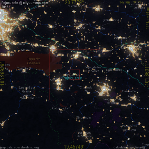
Analysis of Pajacuarán night lights 2016
Square area 10x10 km:
 0%
0%90-99
0%80-89
0.79%70-79
0.4%60-69
1.19%50-59
1.59%40-49
1.98%30-39
1.98%20-29
0%10-19
0.79%0-9
91.27%Square area 50x50 km:
0.15%90-99
0.61%80-89
2.22%70-79
1.52%60-69
0.85%50-59
0.79%40-49
1.89%30-39
1.54%20-29
1.67%10-19
7.9%0-9
80.85%Clear (daylight) street map image can be seen on geolist.org.
Map coordinates:
20° 46' 40.4" North, 103° 16' 9.7" West
20° 7' 8.7" North, 102° 33' 58.4" West
19° 27' 27" North, 101° 51' 47.2" West
Some cities around Pajacuarán sort by population:
• Sahuayo de Morelos
17 km =10.6 mi,  246°
246°
• La Barca
18.9 km =11.7 mi,  6°
6°
• Jiquílpan de Juárez
21.2 km =13.2 mi,  229°
229°
• Jamay
24.4 km =15.2 mi,  322°
322°
• Venustiano Carranza
9.2 km =5.7 mi,  267°
267°
• Vista Hermosa de Negrete
19.5 km =12.1 mi,  29°
29°
• Santiago Tangamandapio
22.7 km =14.1 mi,  143°
143°
• Chavinda
16.7 km =10.4 mi, 138°
3993926 (p: 10,014)
Sources (retrieved 2019-11-25):
» Earth at Night: Flat Maps 2012, 2016