Chavinda night lights from space
Night Light of Chavinda (Michoacán) from space (Mexico) Src. Average luminocity for 10x10km area is 6.6429% and for 50x50km: 7.7552%.
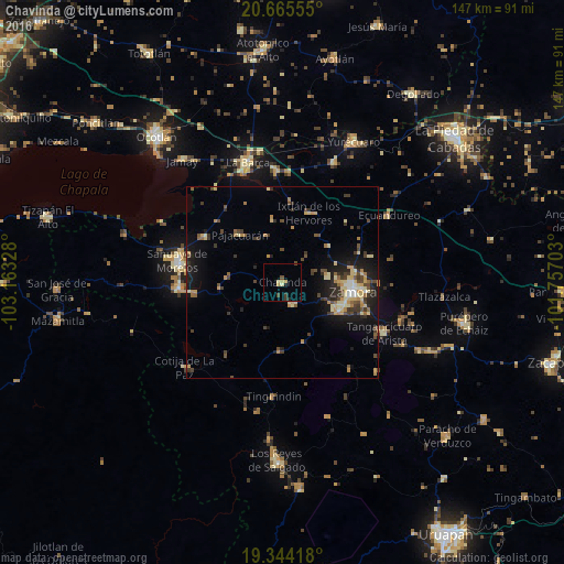
Analysis of Chavinda night lights 2016
Square area 10x10 km:
 0%
0%90-99
0.4%80-89
1.19%70-79
2.18%60-69
0.2%50-59
0.4%40-49
1.39%30-39
1.79%20-29
0.79%10-19
0.79%0-9
90.87%Square area 50x50 km:
0.19%90-99
0.69%80-89
1.72%70-79
1.23%60-69
0.8%50-59
0.73%40-49
1.9%30-39
1.62%20-29
1.65%10-19
5.69%0-9
83.77%Clear (daylight) street map image can be seen on geolist.org.
Map coordinates:
20° 39' 56" North, 103° 9' 47.8" West
20° 0' 22.5" North, 102° 27' 36.5" West
19° 20' 39" North, 101° 45' 25.3" West
Some cities around Chavinda sort by population:
• Zamora
18.6 km =11.6 mi,  97°
97°
• Jacona de Plancarte
17 km =10.6 mi,  110°
110°
• Jiquílpan de Juárez
27.1 km =16.8 mi,  267°
267°
• Venustiano Carranza
23.6 km =14.7 mi,  300°
300°
• Santiago Tangamandapio
6.2 km =3.9 mi,  155°
155°
• Pajacuarán
16.7 km =10.4 mi,  318°
318°
• Tarécuato
18.1 km =11.2 mi,  181°
181°
• Ario de Rayón
11.9 km =7.4 mi,  79°
79°
4014420 (p: 6,246)
Sources (retrieved 2019-11-25):
» Earth at Night: Flat Maps 2012, 2016