Los Zacatones night lights from space
Night Light of Los Zacatones (San Luis Potosí) from space (Mexico) Src. Average luminocity for 10x10km area is 0.0198% and for 50x50km: 1.3318%.
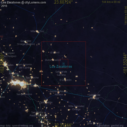
Analysis of Los Zacatones night lights 2016
Square area 10x10 km:
 0%
0%90-99
0%80-89
0%70-79
0%60-69
0%50-59
0%40-49
0%30-39
0%20-29
0%10-19
0%0-9
100%Square area 50x50 km:
0%90-99
0.03%80-89
0.25%70-79
0.3%60-69
0.26%50-59
0.28%40-49
0.4%30-39
0.32%20-29
0.2%10-19
0.13%0-9
97.82%Clear (daylight) street map image can be seen on geolist.org.
Map coordinates:
23° 36' 26.1" North, 102° 45' 31.3" West
22° 57' 41" North, 102° 3' 20" West
22° 18' 44.8" North, 101° 21' 8.8" West
Some cities around Los Zacatones sort by population:
• Guadalupe
53.1 km =33 mi,  243°
243°
• Salinas de Hidalgo
51 km =31.7 mi,  136°
136°
• Trancoso
40.6 km =25.2 mi,  231°
231°
• Tacoaleche
39.1 km =24.3 mi,  246°
246°
• Villa González Ortega
51.9 km =32.2 mi,  164°
164°
• Dulce Grande
12.9 km =8 mi,  290°
290°
• Villa de Cos
47.6 km =29.6 mi,  320°
320°
• Pozos de Gamboa
52.7 km =32.7 mi,  268°
268°
3974149 (p: 5,913)
Sources (retrieved 2019-11-25):
» Earth at Night: Flat Maps 2012, 2016