Lomas de Barrillas night lights from space
Night Light of Lomas de Barrillas (Veracruz) from space (Mexico) Src. Average luminocity for 10x10km area is 55.5346% and for 50x50km: 27.8364%.
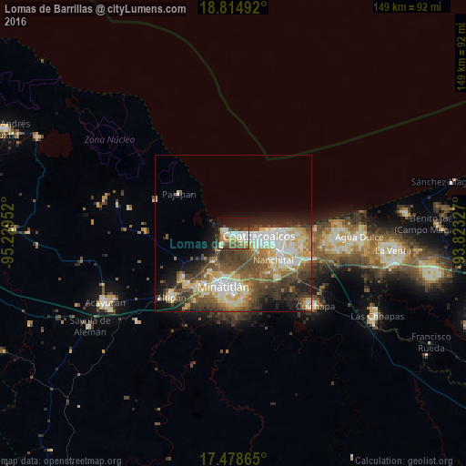
Analysis of Lomas de Barrillas night lights 2016
Square area 10x10 km:
 9.74%
9.74%90-99
13.2%80-89
11.47%70-79
6.28%60-69
4.33%50-59
8.01%40-49
9.52%30-39
4.98%20-29
12.12%10-19
18.61%0-9
1.73%Square area 50x50 km:
3.68%90-99
6.45%80-89
4.63%70-79
2.99%60-69
3.32%50-59
4.55%40-49
6.19%30-39
5.13%20-29
5.3%10-19
6.57%0-9
51.17%Clear (daylight) street map image can be seen on geolist.org.
Map coordinates:
18° 48' 53.7" North, 95° 13' 46.3" West
18° 8' 53" North, 94° 31' 35" West
17° 28' 43.1" North, 93° 49' 23.8" West
Some cities around Lomas de Barrillas sort by population:
• Coatzacoalcos
8.6 km =5.3 mi,  89°
89°
• Minatitlán
16.8 km =10.4 mi,  191°
191°
• Nanchital de Lázaro Cárdenas del Río
15.2 km =9.4 mi,  124°
124°
• Allende
14.1 km =8.8 mi, 86°
• Cosoleacaque
20.2 km =12.6 mi,  214°
214°
• Fraccionamiento Ciudad Olmeca
2.8 km =1.7 mi,  275°
275°
• Mundo Nuevo
15.8 km =9.8 mi,  114°
114°
• El Naranjito
18.7 km =11.6 mi, 206°
8858172 (p: 8,915)
Sources (retrieved 2019-11-25):
» Earth at Night: Flat Maps 2012, 2016