Las Margaritas night lights from space
Night Light of Las Margaritas (Chiapas) from space (Mexico) Src. Average luminocity for 10x10km area is 15.4959% and for 50x50km: 5.7314%.
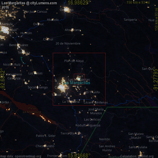
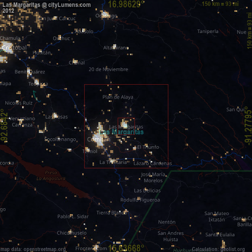
Analysis of Las Margaritas night lights 2016
Square area 10x10 km:
 1.03%
1.03%90-99
3.51%80-89
1.24%70-79
1.65%60-69
0.83%50-59
0.83%40-49
3.31%30-39
4.13%20-29
4.55%10-19
2.07%0-9
76.86%Square area 50x50 km:
0.4%90-99
0.83%80-89
0.64%70-79
0.89%60-69
0.64%50-59
0.42%40-49
1.17%30-39
1.27%20-29
1.36%10-19
3.93%0-9
88.44%Clear (daylight) street map image can be seen on geolist.org.
Map coordinates:
16° 59' 10.6" North, 92° 41' 3.1" West
16° 18' 45.5" North, 91° 58' 51.9" West
15° 38' 12" North, 91° 16' 40.6" West
Some cities around Las Margaritas sort by population:
• Comitán
18 km =11.2 mi,  246°
246°
• Las Rosas
42 km =26.1 mi,  278°
278°
• Altamirano
47.3 km =29.4 mi,  352°
352°
• La Trinitaria
22.9 km =14.2 mi,  199°
199°
• Chanal
48.4 km =30.1 mi,  322°
322°
• El Triunfo
17.9 km =11.1 mi,  133°
133°
• Tzimol
26.5 km =16.5 mi,  237°
237°
• Venustiano Carranza
14.8 km =9.2 mi,  157°
157°
3524744 (p: 20,786)
Sources (retrieved 2019-11-25):
» Earth at Night: Flat Maps 2012, 2016