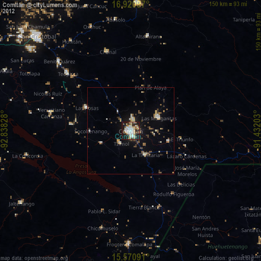
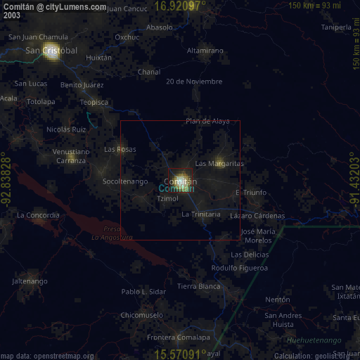
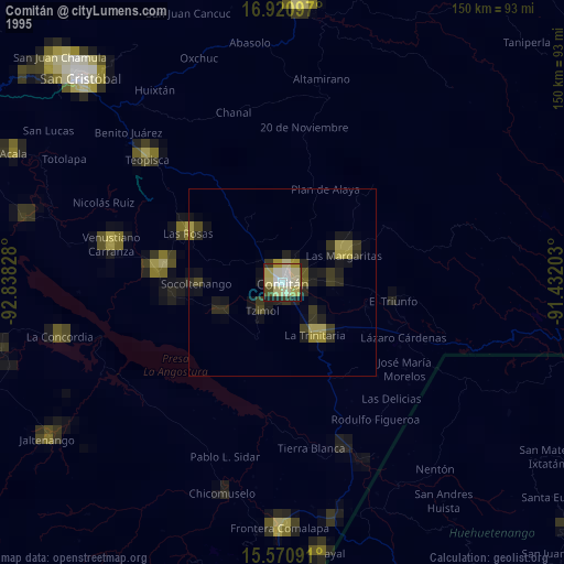
Comitán night lights from space
Night Light of Comitán (Chiapas) from space (Mexico) Src. Average luminocity for 10x10km area is 53.2293% and for 50x50km: 5.7604%.
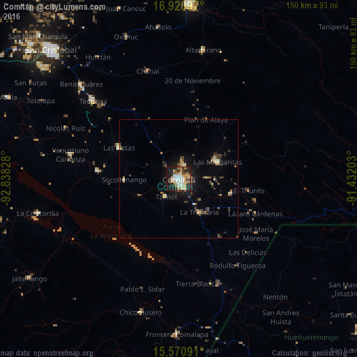
Analysis of Comitán night lights 2016
Square area 10x10 km:
 8.47%
8.47%90-99
12.19%80-89
8.88%70-79
11.16%60-69
5.58%50-59
2.27%40-49
5.17%30-39
8.06%20-29
16.12%10-19
21.9%0-9
0.21%Square area 50x50 km:
0.4%90-99
0.88%80-89
0.66%70-79
0.88%60-69
0.64%50-59
0.45%40-49
1.09%30-39
1.16%20-29
1.45%10-19
3.98%0-9
88.42%Clear (daylight) street map image can be seen on geolist.org.
Map coordinates:
16° 55' 15.5" North, 92° 50' 17.8" West
16° 14' 49.6" North, 92° 8' 6.5" West
15° 34' 15.3" North, 91° 25' 55.3" West
Some cities around Comitán sort by population:
• Las Margaritas
18 km =11.2 mi,  66°
66°
• Las Rosas
28.4 km =17.6 mi,  297°
297°
• Venustiano Carranza
46.8 km =29.1 mi,  282°
282°
• La Trinitaria
16.8 km =10.4 mi,  148°
148°
• San Francisco Pujiltic
34.1 km =21.2 mi, 276°
• El Triunfo
29.9 km =18.6 mi,  99°
99°
• Tzimol
9.1 km =5.7 mi,  219°
219°
• Venustiano Carranza
23.1 km =14.4 mi,  105°
105°
3530367 (p: 97,537)
Sources (retrieved 2019-11-25):
» NASA, Earths city lights 1995
» NASA city lights 2003
» Earth at Night: Flat Maps 2012, 2016