Las Rosas night lights from space
Night Light of Las Rosas (Chiapas) from space (Mexico) Src. Average luminocity for 10x10km area is 6.6281% and for 50x50km: 3.4169%.
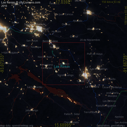
Analysis of Las Rosas night lights 2016
Square area 10x10 km:
 0%
0%90-99
1.86%80-89
2.27%70-79
0.83%60-69
0%50-59
0.83%40-49
0.62%30-39
0.21%20-29
1.65%10-19
0%0-9
91.74%Square area 50x50 km:
0.18%90-99
0.58%80-89
0.46%70-79
0.41%60-69
0.31%50-59
0.41%40-49
0.6%30-39
0.61%20-29
0.72%10-19
2.16%0-9
93.55%Clear (daylight) street map image can be seen on geolist.org.
Map coordinates:
17° 2' 21.1" North, 93° 4' 24.7" West
16° 21' 56.7" North, 92° 22' 13.4" West
15° 41' 23.8" North, 91° 40' 2.2" West
Some cities around Las Rosas sort by population:
• Comitán
28.4 km =17.6 mi,  117°
117°
• Las Margaritas
42 km =26.1 mi,  98°
98°
• Teopisca
22.5 km =14 mi,  330°
330°
• Venustiano Carranza
20.8 km =12.9 mi,  261°
261°
• San Francisco Pujiltic
13.1 km =8.1 mi,  222°
222°
• Chanal
34.6 km =21.5 mi,  20°
20°
• Chanal
39.1 km =24.3 mi,  355°
355°
• Tzimol
28 km =17.4 mi,  136°
136°
3524618 (p: 18,817)
Sources (retrieved 2019-11-25):
» Earth at Night: Flat Maps 2012, 2016