La Orilla night lights from space
Night Light of La Orilla (Michoacán) from space (Mexico) Src. Average luminocity for 10x10km area is 58.0346% and for 50x50km: 5.7925%.
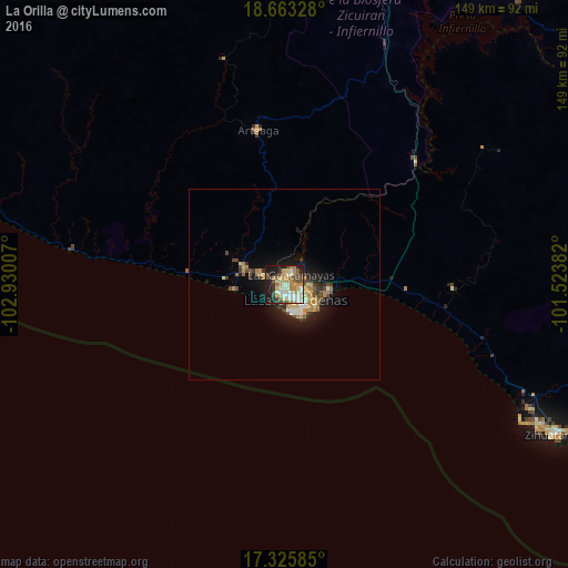
Analysis of La Orilla night lights 2016
Square area 10x10 km:
 6.93%
6.93%90-99
14.29%80-89
10.61%70-79
11.9%60-69
8.23%50-59
6.49%40-49
8.87%30-39
6.06%20-29
8.23%10-19
18.4%0-9
0%Square area 50x50 km:
0.48%90-99
0.84%80-89
0.89%70-79
1.05%60-69
0.89%50-59
0.57%40-49
1.16%30-39
0.71%20-29
1.16%10-19
4.29%0-9
87.97%Clear (daylight) street map image can be seen on geolist.org.
Map coordinates:
18° 39' 47.8" North, 102° 55' 48.3" West
17° 59' 45" North, 102° 13' 37" West
17° 19' 33.1" North, 101° 31' 25.8" West
Some cities around La Orilla sort by population:
• Ciudad Lázaro Cárdenas
2.9 km =1.8 mi,  167°
167°
• Guacamayas
3 km =1.9 mi,  30°
30°
• La Mira Tumbiscatio
76.7 km =47.7 mi,  355°
355°
• La Mira
11.2 km =7 mi,  291°
291°
• Arteaga
40.8 km =25.4 mi,  350°
350°
• Buenos Aires
7 km =4.3 mi,  297°
297°
• Ixtapa
71.9 km =44.7 mi,  120°
120°
• San José Ixtapa (Barrio Viejo)
72.1 km =44.8 mi, 116°
4001056 (p: 20,126)
Sources (retrieved 2019-11-25):
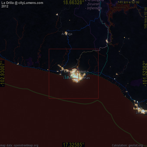
» Earth at Night: Flat Maps 2012, 2016