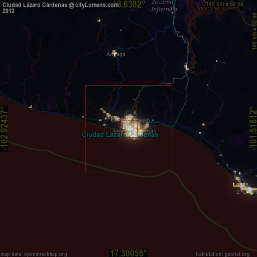
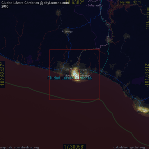
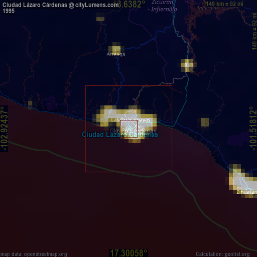
Ciudad Lázaro Cárdenas night lights from space
Night Light of Ciudad Lázaro Cárdenas (Michoacán) from space (Mexico) Src. Average luminocity for 10x10km area is 63.2597% and for 50x50km: 5.7921%.
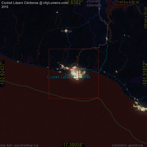
Analysis of Ciudad Lázaro Cárdenas night lights 2016
Square area 10x10 km:
 10.39%
90-99
17.75%80-89
11.9%70-79
11.26%60-69
6.93%50-59
6.71%40-49
8.23%30-39
5.19%20-29
9.31%10-19
11.04%0-9
1.3%Square area 50x50 km:
0.48%90-99
0.84%80-89
0.89%70-79
1.05%60-69
0.89%50-59
0.57%40-49
1.16%30-39
0.71%20-29
1.16%10-19
4.29%0-9
87.97%Clear (daylight) street map image can be seen on geolist.org.
Map coordinates:
18° 38' 17.5" North, 102° 55' 27.7" West
17° 58' 14.4" North, 102° 13' 16.5" West
17° 18' 2.1" North, 101° 31' 5.2" West
Some cities around Ciudad Lázaro Cárdenas sort by population:
• Guacamayas
5.5 km =3.4 mi,  9°
9°
• La Orilla
2.9 km =1.8 mi,  347°
347°
• La Mira Tumbiscatio
79.5 km =49.4 mi,  355°
355°
• La Mira
13.1 km =8.1 mi,  302°
302°
• Arteaga
43.7 km =27.2 mi, 350°
• Buenos Aires
9.1 km =5.7 mi,  311°
311°
• Ixtapa
70 km =43.5 mi,  118°
118°
• San José Ixtapa (Barrio Viejo)
70.3 km =43.7 mi, 115°
4026082 (p: 79,200)
Sources (retrieved 2019-11-25):
» NASA, Earths city lights 1995
» NASA city lights 2003
» Earth at Night: Flat Maps 2012, 2016