Guacamayas night lights from space
Night Light of Guacamayas (Michoacán) from space (Mexico) Src. Average luminocity for 10x10km area is 43.9329% and for 50x50km: 5.7919%.
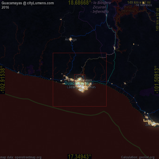

Analysis of Guacamayas night lights 2016
Square area 10x10 km:
 2.38%
2.38%90-99
6.06%80-89
8.87%70-79
12.34%60-69
7.36%50-59
5.41%40-49
8.01%30-39
5.84%20-29
6.06%10-19
25.11%0-9
12.55%Square area 50x50 km:
0.48%90-99
0.84%80-89
0.89%70-79
1.05%60-69
0.89%50-59
0.57%40-49
1.16%30-39
0.71%20-29
1.16%10-19
4.29%0-9
87.97%Clear (daylight) street map image can be seen on geolist.org.
Map coordinates:
18° 41' 12" North, 102° 54' 55.4" West
18° 1' 9.6" North, 102° 12' 44.1" West
17° 20' 57.9" North, 101° 30' 32.9" West
Some cities around Guacamayas sort by population:
• Ciudad Lázaro Cárdenas
5.5 km =3.4 mi,  189°
189°
• La Orilla
3 km =1.9 mi,  210°
210°
• La Mira Tumbiscatio
74.2 km =46.1 mi,  354°
354°
• La Mira
12.1 km =7.5 mi,  277°
277°
• Arteaga
38.5 km =23.9 mi, 347°
• Buenos Aires
7.8 km =4.8 mi,  274°
274°
• Ixtapa
71.9 km =44.7 mi,  122°
122°
• San José Ixtapa (Barrio Viejo)
72 km =44.7 mi, 119°
4026075 (p: 37,980)
Sources (retrieved 2019-11-25):
» Earth at Night: Flat Maps 2012, 2016