Juchipila night lights from space
Night Light of Juchipila (Zacatecas) from space (Mexico) Src. Average luminocity for 10x10km area is 14.4242% and for 50x50km: 1.6214%.
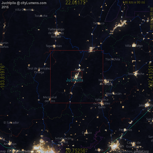
Analysis of Juchipila night lights 2016
Square area 10x10 km:
 0%
0%90-99
0.57%80-89
5.11%70-79
1.14%60-69
1.14%50-59
1.33%40-49
5.11%30-39
2.84%20-29
0.95%10-19
0.57%0-9
81.25%Square area 50x50 km:
0%90-99
0.1%80-89
0.4%70-79
0.26%60-69
0.16%50-59
0.19%40-49
0.45%30-39
0.31%20-29
0.26%10-19
0.15%0-9
97.73%Clear (daylight) street map image can be seen on geolist.org.
Map coordinates:
22° 3' 42.3" North, 103° 49' 11.1" West
21° 24' 31" North, 103° 6' 59.9" West
20° 45' 9.2" North, 102° 24' 48.6" West
Some cities around Juchipila sort by population:
• Teocaltiche
56.2 km =34.9 mi,  87°
87°
• Nochistlán de Mejía
28.5 km =17.7 mi,  99°
99°
• Tlaltenango de Sánchez Román
45.8 km =28.5 mi,  335°
335°
• Villa Hidalgo
62.2 km =38.6 mi,  61°
61°
• Jalpa
28.9 km =18 mi,  29°
29°
• Yahualica de González Gallo
34.9 km =21.7 mi,  136°
136°
• Tabasco
54.8 km =34.1 mi,  22°
22°
• Ixtlahuacán del Río
61.9 km =38.5 mi,  191°
191°
4003739 (p: 6,035)
Sources (retrieved 2019-11-25):
» Earth at Night: Flat Maps 2012, 2016