Huimanguillo night lights from space
Night Light of Huimanguillo (Tabasco) from space (Mexico) Src. Average luminocity for 10x10km area is 25.2251% and for 50x50km: 21.1326%.
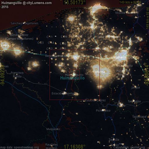
Analysis of Huimanguillo night lights 2016
Square area 10x10 km:
 1.73%
1.73%90-99
1.3%80-89
4.76%70-79
1.95%60-69
1.73%50-59
2.38%40-49
4.98%30-39
10.17%20-29
16.23%10-19
23.59%0-9
31.17%Square area 50x50 km:
1.36%90-99
3.09%80-89
3.57%70-79
1.55%60-69
2.36%50-59
3.16%40-49
6.12%30-39
6.82%20-29
7.63%10-19
11.52%0-9
52.82%Clear (daylight) street map image can be seen on geolist.org.
Map coordinates:
18° 30' 6.2" North, 94° 5' 32.6" West
17° 50' 1.2" North, 93° 23' 21.3" West
17° 9' 47.1" North, 92° 41' 10.1" West
Some cities around Huimanguillo sort by population:
• Cárdenas
18.7 km =11.6 mi,  4°
4°
• Reforma
25.7 km =16 mi,  82°
82°
• Cunduacán
34.5 km =21.4 mi,  41°
41°
• Chontalpa
21 km =13 mi,  207°
207°
• Juárez
32.7 km =20.3 mi,  140°
140°
• Luis Gil Pérez
34 km =21.1 mi, 82°
• Santa Rosalía
28.5 km =17.7 mi,  6°
6°
• Anacleto Canabal 2da. Sección
41.7 km =25.9 mi,  67°
67°
3526908 (p: 27,344)
Sources (retrieved 2019-11-25):
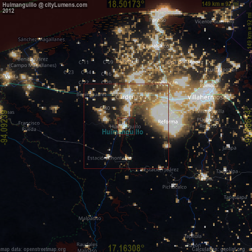
» Earth at Night: Flat Maps 2012, 2016