Cárdenas night lights from space
Night Light of Cárdenas (Tabasco) from space (Mexico) Src. Average luminocity for 10x10km area is 65.9827% and for 50x50km: 29.9027%.
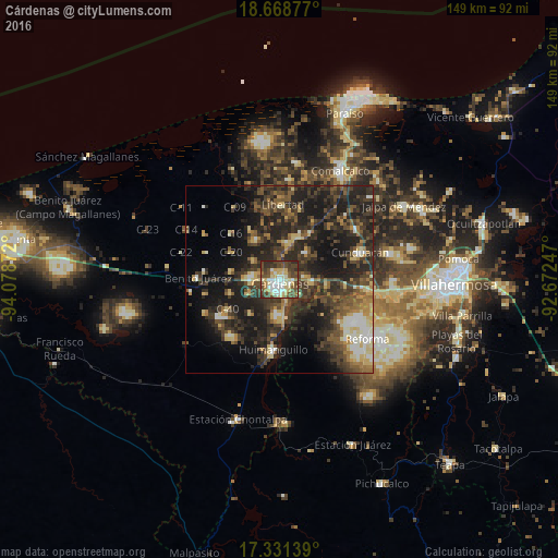
Analysis of Cárdenas night lights 2016
Square area 10x10 km:
 9.96%
9.96%90-99
16.02%80-89
17.32%70-79
3.25%60-69
4.55%50-59
8.87%40-49
25.97%30-39
8.01%20-29
6.06%10-19
0%0-9
0%Square area 50x50 km:
1.48%90-99
3.94%80-89
4.79%70-79
2.14%60-69
3.57%50-59
4.95%40-49
8.03%30-39
10.48%20-29
14.04%10-19
18.6%0-9
27.97%Clear (daylight) street map image can be seen on geolist.org.
Map coordinates:
18° 40' 7.6" North, 94° 4' 43.4" West
18° 0' 4.9" North, 93° 22' 32.1" West
17° 19' 53" North, 92° 40' 20.9" West
Some cities around Cárdenas sort by population:
• Comalcalco
33.2 km =20.6 mi,  28°
28°
• Huimanguillo
18.7 km =11.6 mi,  184°
184°
• Reforma
28.4 km =17.6 mi,  122°
122°
• Cunduacán
22.6 km =14 mi,  71°
71°
• Villa Tecolutilla
31.7 km =19.7 mi,  7°
7°
• Santa Rosalía
9.9 km =6.2 mi, 10°
• Miguel Hidalgo
29.2 km =18.1 mi, 13°
• Villa Aldama
26.8 km =16.7 mi, 5°
3531576 (p: 91,558)
Sources (retrieved 2019-11-25):
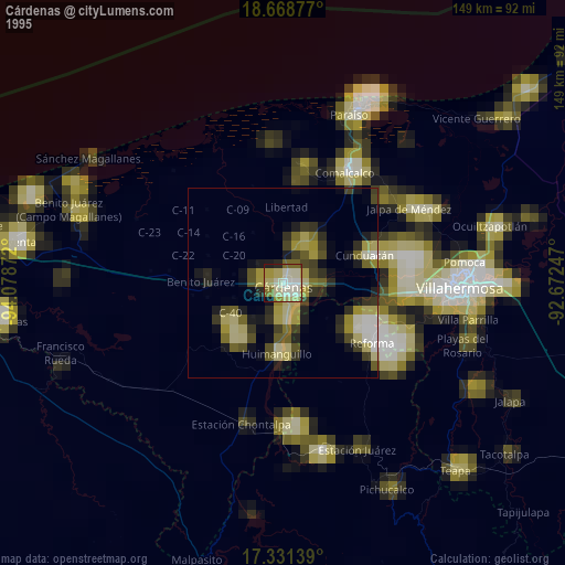
» NASA, Earths city lights 1995
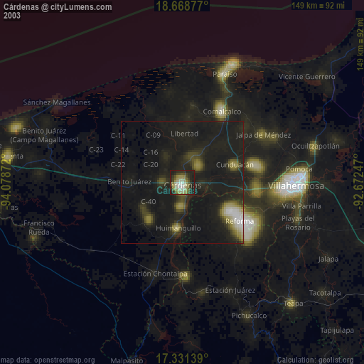
» NASA city lights 2003
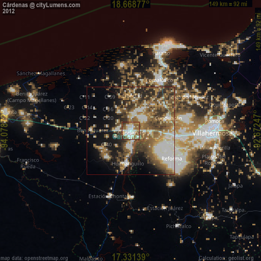
» Earth at Night: Flat Maps 2012, 2016