Cozumel night lights from space
Night Light of Cozumel (Quintana Roo) from space (Mexico) Src. Average luminocity for 10x10km area is 34.1686% and for 50x50km: 5.8127%.
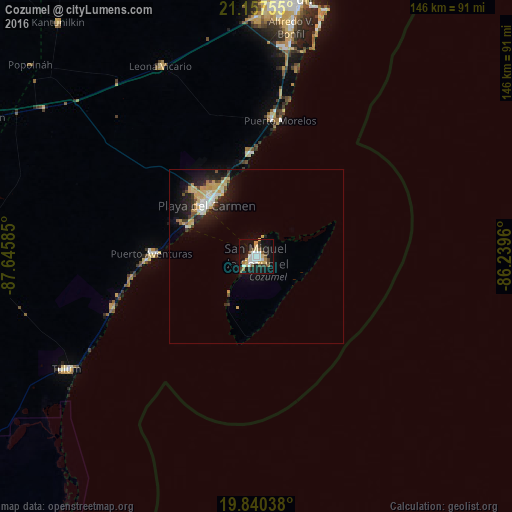

Analysis of Cozumel night lights 2016
Square area 10x10 km:
 7.01%
7.01%90-99
6.25%80-89
5.49%70-79
2.84%60-69
2.46%50-59
3.98%40-49
4.73%30-39
2.84%20-29
2.84%10-19
40.72%0-9
20.83%Square area 50x50 km:
0.71%90-99
0.84%80-89
1.49%70-79
0.68%60-69
0.23%50-59
0.54%40-49
0.57%30-39
0.62%20-29
1.41%10-19
5.42%0-9
87.48%Clear (daylight) street map image can be seen on geolist.org.
Map coordinates:
21° 9' 27.2" North, 87° 38' 45.1" West
20° 30' 1.4" North, 86° 56' 33.8" West
19° 50' 25.4" North, 86° 14' 22.6" West
Some cities around Cozumel sort by population:
• Cancún
75.6 km =47 mi,  7°
7°
• Playa del Carmen
20.1 km =12.5 mi,  314°
314°
• Tulum
63 km =39.1 mi,  239°
239°
• Alfredo V. Bonfil
66.1 km =41.1 mi, 8°
• Isla Mujeres
84.2 km =52.3 mi,  15°
15°
• Puerto Aventuras
29.6 km =18.4 mi,  270°
270°
• Leona Vicario
60.7 km =37.7 mi,  333°
333°
• X-Cán
85.3 km =53 mi,  297°
297°
3530103 (p: 77,236)
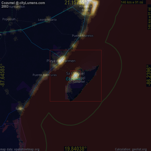
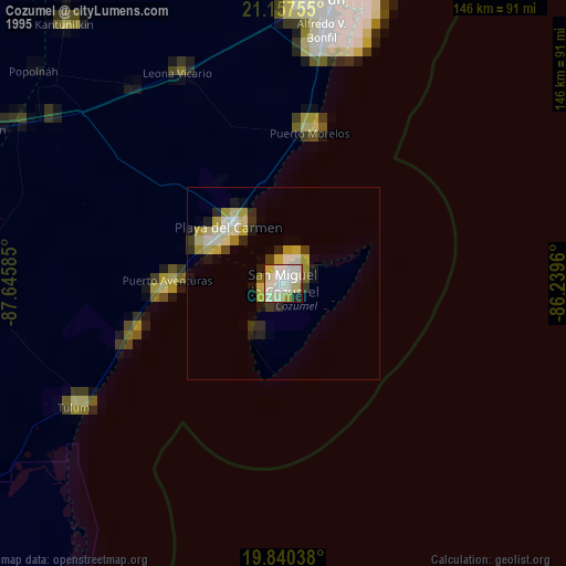
Sources (retrieved 2019-11-25):
» NASA, Earths city lights 1995
» NASA city lights 2003
» Earth at Night: Flat Maps 2012, 2016