Playa del Carmen night lights from space
Night Light of Playa del Carmen (Quintana Roo) from space (Mexico) Src. Average luminocity for 10x10km area is 52.4318% and for 50x50km: 7.2553%.
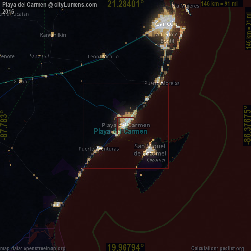
Analysis of Playa del Carmen night lights 2016
Square area 10x10 km:
 9.47%
9.47%90-99
10.98%80-89
19.13%70-79
4.36%60-69
1.52%50-59
3.79%40-49
1.89%30-39
5.3%20-29
18.94%10-19
18.37%0-9
6.25%Square area 50x50 km:
0.83%90-99
0.97%80-89
1.75%70-79
0.77%60-69
0.45%50-59
0.69%40-49
0.82%30-39
0.85%20-29
1.59%10-19
5.6%0-9
85.68%Clear (daylight) street map image can be seen on geolist.org.
Map coordinates:
21° 17' 2.4" North, 87° 46' 58.8" West
20° 37' 38.6" North, 87° 4' 47.5" West
19° 58' 4.6" North, 86° 22' 36.3" West
Some cities around Playa del Carmen sort by population:
• Cancún
65.5 km =40.7 mi,  21°
21°
• Cozumel
20.1 km =12.5 mi,  134°
134°
• Tulum
61.1 km =38 mi,  220°
220°
• Alfredo V. Bonfil
56.6 km =35.2 mi,  25°
25°
• Kantunilkín
67.6 km =42 mi,  321°
321°
• Puerto Aventuras
20.8 km =12.9 mi,  227°
227°
• Leona Vicario
42.2 km =26.2 mi,  342°
342°
• X-Cán
66.4 km =41.3 mi,  292°
292°
3521342 (p: 149,923)
Sources (retrieved 2019-11-25):
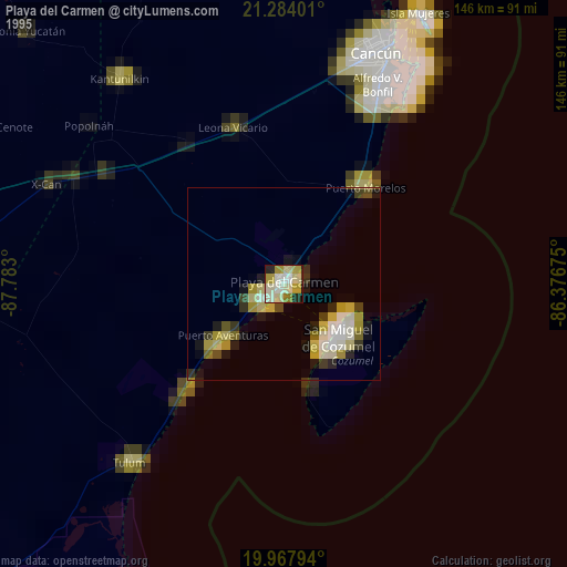
» NASA, Earths city lights 1995
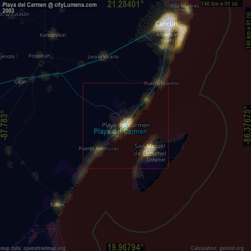
» NASA city lights 2003
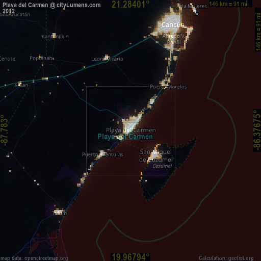
» Earth at Night: Flat Maps 2012, 2016