Conkal night lights from space
Night Light of Conkal (Yucatán) from space (Mexico) Src. Average luminocity for 10x10km area is 47.254% and for 50x50km: 29.9779%.
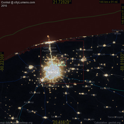
Analysis of Conkal night lights 2016
Square area 10x10 km:
 0.6%
0.6%90-99
4.96%80-89
18.65%70-79
4.17%60-69
5.95%50-59
8.73%40-49
9.92%30-39
10.32%20-29
13.29%10-19
21.63%0-9
1.79%Square area 50x50 km:
6.92%90-99
5.84%80-89
6.56%70-79
1.87%60-69
2.4%50-59
3.69%40-49
4.41%30-39
3.41%20-29
4.71%10-19
10.19%0-9
50%Clear (daylight) street map image can be seen on geolist.org.
Map coordinates:
21° 43' 41.8" North, 90° 13' 23.1" West
21° 4' 25.1" North, 89° 31' 11.8" West
20° 24' 58" North, 88° 49' 0.6" West
Some cities around Conkal sort by population:
• Mérida
14.9 km =9.3 mi,  222°
222°
• Kanasín
16 km =9.9 mi,  194°
194°
• Motul
24.7 km =15.3 mi,  84°
84°
• Tixkokob
15.2 km =9.4 mi,  121°
121°
• Caucel
20.1 km =12.5 mi,  251°
251°
• Chicxulub Puerto
26.1 km =16.2 mi,  341°
341°
• Cholul
5.3 km =3.3 mi,  229°
229°
• Itzincab Palomeque
25.5 km =15.8 mi, 226°
3530295 (p: 7,173)
Sources (retrieved 2019-11-25):
» Earth at Night: Flat Maps 2012, 2016