Cholul night lights from space
Night Light of Cholul (Yucatán) from space (Mexico) Src. Average luminocity for 10x10km area is 79.2163% and for 50x50km: 29.8555%.
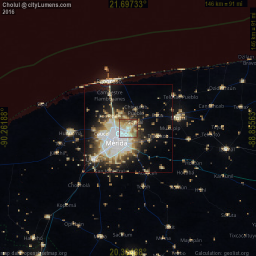
Analysis of Cholul night lights 2016
Square area 10x10 km:
 19.25%
90-99
16.47%80-89
27.58%70-79
4.56%60-69
8.13%50-59
14.68%40-49
6.35%30-39
2.78%20-29
0.2%10-19
0%0-9
0%Square area 50x50 km:
6.74%90-99
5.58%80-89
6.21%70-79
1.84%60-69
2.56%50-59
3.52%40-49
4.42%30-39
3.54%20-29
5.29%10-19
12.49%0-9
47.79%Clear (daylight) street map image can be seen on geolist.org.
Map coordinates:
21° 41' 50.4" North, 90° 15' 42.8" West
21° 2' 33.2" North, 89° 33' 31.5" West
20° 23' 5.6" North, 88° 51' 20.3" West
Some cities around Cholul sort by population:
• Mérida
9.6 km =6 mi,  218°
218°
• Kanasín
12 km =7.5 mi,  179°
179°
• Uman
26.4 km =16.4 mi,  227°
227°
• Acanceh
27.8 km =17.3 mi,  156°
156°
• Tixkokob
17.6 km =10.9 mi,  104°
104°
• Conkal
5.3 km =3.3 mi,  49°
49°
• Caucel
15.3 km =9.5 mi,  258°
258°
• Itzincab Palomeque
20.2 km =12.6 mi, 225°
3530758 (p: 5,880)
Sources (retrieved 2019-11-25):
» Earth at Night: Flat Maps 2012, 2016