Caucel night lights from space
Night Light of Caucel (Yucatán) from space (Mexico) Src. Average luminocity for 10x10km area is 73.9048% and for 50x50km: 29.4828%.
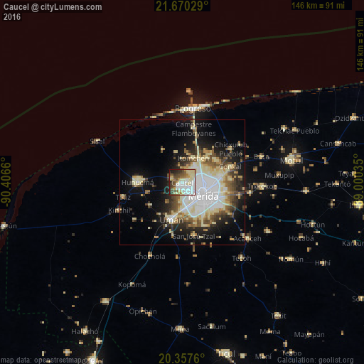
Analysis of Caucel night lights 2016
Square area 10x10 km:
 18.65%
90-99
22.82%80-89
15.48%70-79
5.16%60-69
3.97%50-59
8.13%40-49
11.51%30-39
7.94%20-29
4.76%10-19
1.59%0-9
0%Square area 50x50 km:
6.75%90-99
5.8%80-89
6.26%70-79
1.91%60-69
2.55%50-59
3.15%40-49
4.21%30-39
3.39%20-29
5.08%10-19
11.51%0-9
49.37%Clear (daylight) street map image can be seen on geolist.org.
Map coordinates:
21° 40' 13" North, 90° 24' 23.8" West
21° 0' 55.4" North, 89° 42' 12.5" West
20° 21' 27.4" North, 89° 0' 1.3" West
Some cities around Caucel sort by population:
• Mérida
10 km =6.2 mi,  116°
116°
• Kanasín
17.5 km =10.9 mi, 120°
• Uman
15.5 km =9.6 mi,  196°
196°
• Hunucmá
17.9 km =11.1 mi,  270°
270°
• Conkal
20.1 km =12.5 mi,  71°
71°
• Kinchil
27.7 km =17.2 mi,  246°
246°
• Cholul
15.3 km =9.5 mi,  78°
78°
• Itzincab Palomeque
11 km =6.8 mi,  177°
177°
3531406 (p: 6,988)
Sources (retrieved 2019-11-25):
» Earth at Night: Flat Maps 2012, 2016