Cojumatlán de Régules night lights from space
Night Light of Cojumatlán de Régules (Michoacán) from space (Mexico) Src. Average luminocity for 10x10km area is 3.0556% and for 50x50km: 5.7324%.
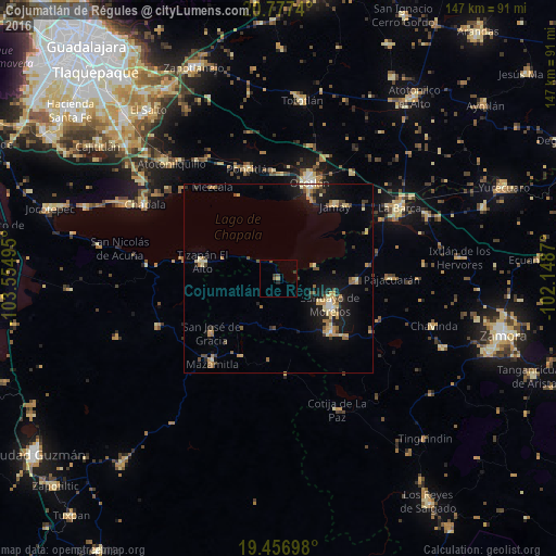
Analysis of Cojumatlán de Régules night lights 2016
Square area 10x10 km:
 0%
0%90-99
0%80-89
0%70-79
0.79%60-69
0%50-59
0.79%40-49
1.98%30-39
1.98%20-29
0.6%10-19
0.2%0-9
93.65%Square area 50x50 km:
0.14%90-99
0.41%80-89
1.26%70-79
0.93%60-69
0.89%50-59
0.63%40-49
1.02%30-39
0.84%20-29
0.96%10-19
4.48%0-9
88.45%Clear (daylight) street map image can be seen on geolist.org.
Map coordinates:
20° 46' 38.6" North, 103° 33' 17.8" West
20° 7' 6.9" North, 102° 51' 6.6" West
19° 27' 25.1" North, 102° 8' 55.3" West
Some cities around Cojumatlán de Régules sort by population:
• Sahuayo de Morelos
15.7 km =9.8 mi,  115°
115°
• Jiquílpan de Juárez
19.5 km =12.1 mi,  134°
134°
• Jamay
24.6 km =15.3 mi,  37°
37°
• Tizapán el Alto
20.6 km =12.8 mi,  283°
283°
• Venustiano Carranza
20.7 km =12.9 mi,  90°
90°
• San José de Gracia
22.8 km =14.2 mi,  231°
231°
• Cuitzeo (La Estancia)
25.9 km =16.1 mi,  15°
15°
• San Pedro Itzicán
24.5 km =15.2 mi,  334°
334°
4013522 (p: 6,763)
Sources (retrieved 2019-11-25):
» Earth at Night: Flat Maps 2012, 2016