Ciudad Río Bravo night lights from space
Night Light of Ciudad Río Bravo (Tamaulipas) from space (Mexico) Src. Average luminocity for 10x10km area is 49.621% and for 50x50km: 29.9583%.
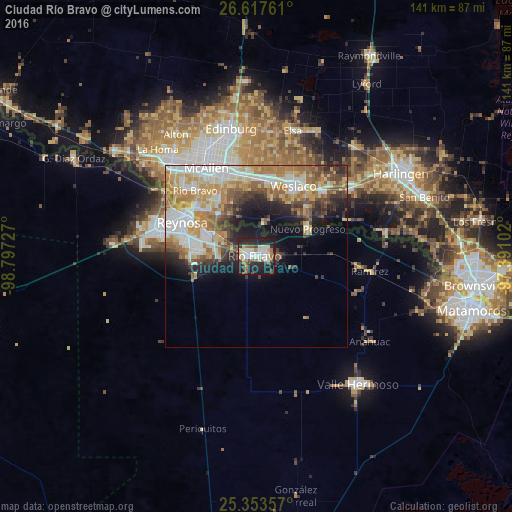
Analysis of Ciudad Río Bravo night lights 2016
Square area 10x10 km:
 10.32%
90-99
12.3%80-89
6.35%70-79
3.37%60-69
3.97%50-59
7.54%40-49
3.77%30-39
7.14%20-29
23.61%10-19
21.23%0-9
0.4%Square area 50x50 km:
6.04%90-99
5.62%80-89
4.55%70-79
4.82%60-69
5.37%50-59
3.93%40-49
3.43%30-39
3.12%20-29
4.98%10-19
7.78%0-9
50.36%Clear (daylight) street map image can be seen on geolist.org.
Map coordinates:
26° 37' 3.4" North, 98° 47' 50.2" West
25° 59' 14.2" North, 98° 5' 38.9" West
25° 21' 12.9" North, 97° 23' 27.7" West
Some cities around Ciudad Río Bravo sort by population:
• Reynosa
22 km =13.7 mi,  298°
298°
• Weslaco, US
21.8 km =13.5 mi,  28°
28°
• San Juan, US
23.3 km =14.5 mi,  344°
344°
• Alamo, US
22 km =13.7 mi,  352°
352°
• Donna, US
20.8 km =12.9 mi,  11°
11°
• Hidalgo, US
21 km =13 mi,  306°
306°
• Nuevo Progreso
16.1 km =10 mi,  61°
61°
• Progreso, US
18 km =11.2 mi,  49°
49°
3520271 (p: 95,647)
Sources (retrieved 2019-11-25):
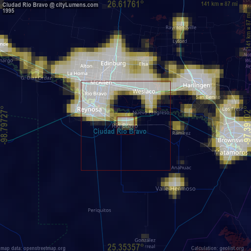
» NASA, Earths city lights 1995
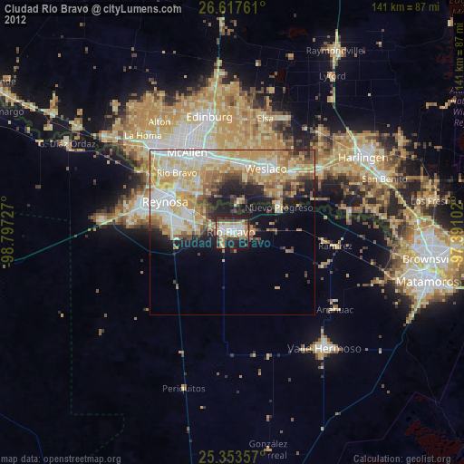
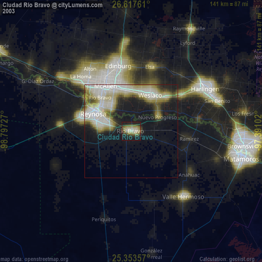
» NASA city lights 2003
» Earth at Night: Flat Maps 2012, 2016