Ciudad Mante night lights from space
Night Light of Ciudad Mante (Tamaulipas) from space (Mexico) Src. Average luminocity for 10x10km area is 35.8433% and for 50x50km: 2.0577%.
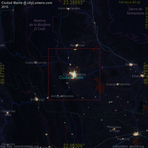
Analysis of Ciudad Mante night lights 2016
Square area 10x10 km:
 2.58%
2.58%90-99
6.75%80-89
5.95%70-79
7.74%60-69
5.75%50-59
3.37%40-49
5.56%30-39
2.98%20-29
4.56%10-19
38.1%0-9
16.67%Square area 50x50 km:
0.1%90-99
0.28%80-89
0.27%70-79
0.36%60-69
0.35%50-59
0.19%40-49
0.35%30-39
0.25%20-29
0.43%10-19
1.89%0-9
95.53%Clear (daylight) street map image can be seen on geolist.org.
Map coordinates:
23° 23' 23.8" North, 99° 40' 37.3" West
22° 44' 34.9" North, 98° 58' 26" West
22° 5' 35" North, 98° 16' 14.8" West
Some cities around Ciudad Mante sort by population:
• Ébano
84.7 km =52.6 mi,  133°
133°
• Tamuín
84.4 km =52.4 mi,  166°
166°
• Ursulo Galván
66.9 km =41.6 mi,  91°
91°
• González
56.8 km =35.3 mi,  80°
80°
• El Naranjo
43.8 km =27.2 mi,  236°
236°
• Xicoténcatl
28.3 km =17.6 mi,  6°
6°
• Ponciano Arriaga
66.5 km =41.3 mi,  143°
143°
• Ocampo
39.1 km =24.3 mi,  287°
287°
3528756 (p: 84,787)
Sources (retrieved 2019-11-25):
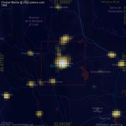
» NASA, Earths city lights 1995
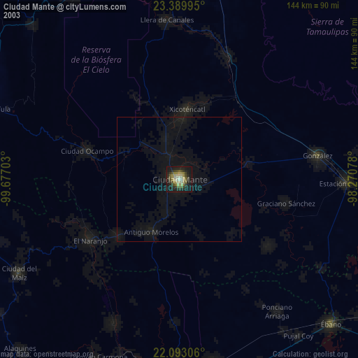
» NASA city lights 2003
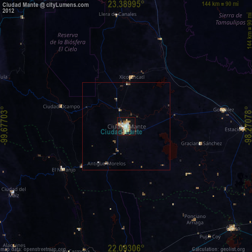
» Earth at Night: Flat Maps 2012, 2016