Ursulo Galván night lights from space
Night Light of Ursulo Galván (Tamaulipas) from space (Mexico) Src. Average luminocity for 10x10km area is 5.8571% and for 50x50km: 0.8954%.
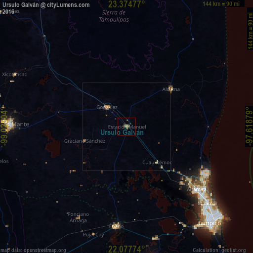
Analysis of Ursulo Galván night lights 2016
Square area 10x10 km:
 0%
0%90-99
0%80-89
0%70-79
1.39%60-69
2.38%50-59
1.79%40-49
1.79%30-39
1.39%20-29
0%10-19
0.79%0-9
90.48%Square area 50x50 km:
0%90-99
0.02%80-89
0.13%70-79
0.14%60-69
0.25%50-59
0.31%40-49
0.17%30-39
0.25%20-29
0.06%10-19
0.1%0-9
98.56%Clear (daylight) street map image can be seen on geolist.org.
Map coordinates:
23° 22' 29.2" North, 99° 1' 30.1" West
22° 43' 40" North, 98° 19' 18.9" West
22° 4' 39.9" North, 97° 37' 7.6" West
Some cities around Ursulo Galván sort by population:
• Miramar
59.5 km =37 mi,  133°
133°
• Ciudad Mante
66.9 km =41.6 mi,  271°
271°
• Altamira
54.2 km =33.7 mi, 133°
• Ébano
57 km =35.4 mi,  185°
185°
• Aldama
33.2 km =20.6 mi,  49°
49°
• González
15.5 km =9.6 mi,  315°
315°
• Ponciano Arriaga
58.6 km =36.4 mi,  207°
207°
• Cuauhtémoc
26.9 km =16.7 mi,  139°
139°
3523608 (p: 12,077)
Sources (retrieved 2019-11-25):
» Earth at Night: Flat Maps 2012, 2016