Xicoténcatl night lights from space
Night Light of Xicoténcatl (Tamaulipas) from space (Mexico) Src. Average luminocity for 10x10km area is 5.248% and for 50x50km: 0.5766%.
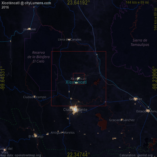
Analysis of Xicoténcatl night lights 2016
Square area 10x10 km:
 0%
0%90-99
0.2%80-89
1.39%70-79
1.59%60-69
0.79%50-59
1.59%40-49
0.79%30-39
0.79%20-29
0%10-19
0%0-9
92.86%Square area 50x50 km:
0%90-99
0.01%80-89
0.06%70-79
0.1%60-69
0.06%50-59
0.06%40-49
0.16%30-39
0.12%20-29
0.19%10-19
0.61%0-9
98.63%Clear (daylight) street map image can be seen on geolist.org.
Map coordinates:
23° 38' 30.9" North, 99° 38' 43.1" West
22° 59' 46.4" North, 98° 56' 31.8" West
22° 20' 50.8" North, 98° 14' 20.6" West
Some cities around Xicoténcatl sort by population:
• Ciudad Victoria
85.5 km =53.1 mi,  345°
345°
• Ciudad Mante
28.3 km =17.6 mi,  186°
186°
• Ursulo Galván
70.2 km =43.6 mi,  115°
115°
• González
56 km =34.8 mi,  109°
109°
• El Naranjo
65.7 km =40.8 mi,  217°
217°
• Ciudad Tula
78.7 km =48.9 mi,  270°
270°
• Jaumave
63.9 km =39.7 mi,  315°
315°
• Ocampo
43.9 km =27.3 mi,  247°
247°
3483063 (p: 9,593)
Sources (retrieved 2019-11-25):
» Earth at Night: Flat Maps 2012, 2016