Ciudad del Carmen night lights from space
Night Light of Ciudad del Carmen (Campeche) from space (Mexico) Src. Average luminocity for 10x10km area is 42.7748% and for 50x50km: 3.0024%.
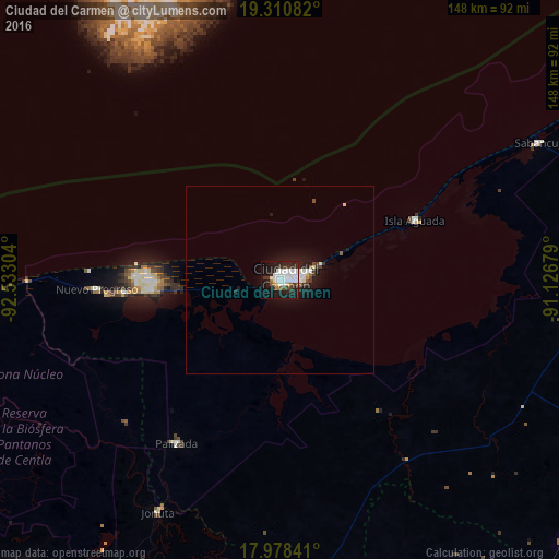

Analysis of Ciudad del Carmen night lights 2016
Square area 10x10 km:
 14.67%
90-99
11.78%80-89
1.45%70-79
0.83%60-69
1.65%50-59
2.27%40-49
2.69%30-39
7.02%20-29
14.67%10-19
31.82%0-9
11.16%Square area 50x50 km:
0.72%90-99
0.75%80-89
0.15%70-79
0.03%60-69
0.13%50-59
0.18%40-49
0.32%30-39
0.5%20-29
0.82%10-19
3.01%0-9
93.4%Clear (daylight) street map image can be seen on geolist.org.
Map coordinates:
19° 18' 39" North, 92° 31' 58.9" West
18° 38' 45.3" North, 91° 49' 47.7" West
17° 58' 42.3" North, 91° 7' 36.4" West
Some cities around Ciudad del Carmen sort by population:
• Frontera
86.7 km =53.9 mi,  262°
262°
• Emiliano Zapata
100.9 km =62.7 mi,  176°
176°
• Balancán
98.1 km =61 mi,  161°
161°
• Candelaria
97.3 km =60.5 mi,  121°
121°
• Sabancuy
77.7 km =48.3 mi,  62°
62°
• Jonuta
69.9 km =43.4 mi,  207°
207°
• Isla Aguada
38.8 km =24.1 mi,  66°
66°
• El Triunfo
106.5 km =66.2 mi,  139°
139°
3530599 (p: 169,466)
Sources (retrieved 2019-11-25):
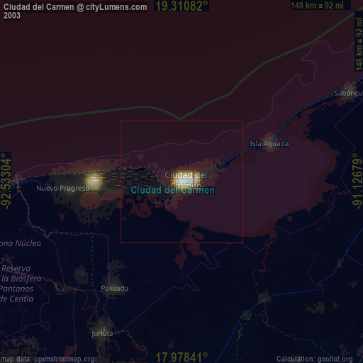
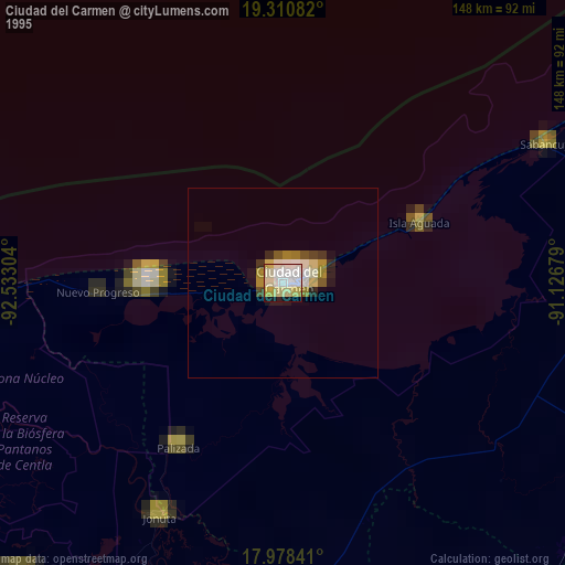
» NASA, Earths city lights 1995
» NASA city lights 2003
» Earth at Night: Flat Maps 2012, 2016