Frontera night lights from space
Night Light of Frontera (Tabasco) from space (Mexico) Src. Average luminocity for 10x10km area is 13.1612% and for 50x50km: 2.7555%.
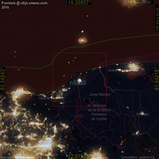
Analysis of Frontera night lights 2016
Square area 10x10 km:
 3.1%
3.1%90-99
3.51%80-89
0%70-79
0.83%60-69
1.65%50-59
0.83%40-49
0.83%30-39
0.83%20-29
3.31%10-19
1.03%0-9
84.09%Square area 50x50 km:
0.15%90-99
0.33%80-89
0.28%70-79
0.23%60-69
0.41%50-59
0.41%40-49
0.47%30-39
0.89%20-29
0.63%10-19
2.06%0-9
94.14%Clear (daylight) street map image can be seen on geolist.org.
Map coordinates:
19° 12' 30.9" North, 93° 20' 54.3" West
18° 32' 35.7" North, 92° 38' 43.1" West
17° 52' 31.3" North, 91° 56' 31.8" West
Some cities around Frontera sort by population:
• Paraiso
62 km =38.5 mi,  255°
255°
• Jalpa de Méndez
60.1 km =37.3 mi,  227°
227°
• Nacajuca
57.2 km =35.5 mi,  223°
223°
• Tamulte de las Sabanas
44.9 km =27.9 mi,  198°
198°
• Villa Vicente Guerrero
31.5 km =19.6 mi,  237°
237°
• Medellín y Madero Segunda Sección
52.6 km =32.7 mi, 204°
• Macultepec
49.3 km =30.6 mi,  207°
207°
• Ayapa
60.7 km =37.7 mi, 234°
3527545 (p: 22,795)
Sources (retrieved 2019-11-25):
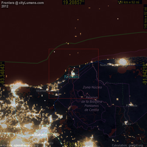
» Earth at Night: Flat Maps 2012, 2016