Lázaro Cárdenas night lights from space
Night Light of Lázaro Cárdenas (Chihuahua) from space (Mexico) Src. Average luminocity for 10x10km area is 7.756% and for 50x50km: 5.3283%.
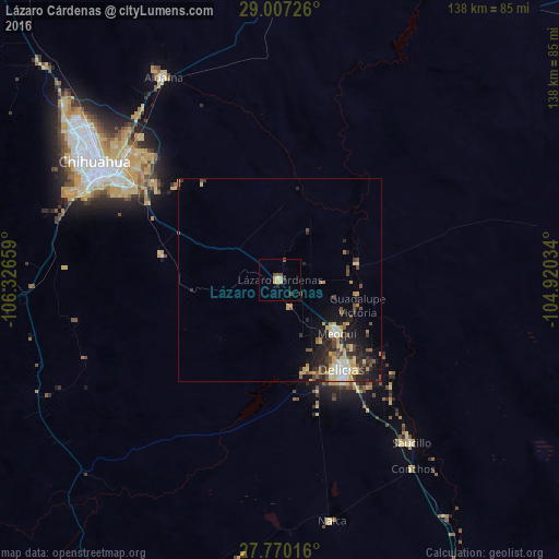
Analysis of Lázaro Cárdenas night lights 2016
Square area 10x10 km:
 0.4%
0.4%90-99
0.4%80-89
1.59%70-79
2.38%60-69
0%50-59
1.19%40-49
1.59%30-39
1.19%20-29
1.19%10-19
0.2%0-9
89.88%Square area 50x50 km:
0.34%90-99
0.54%80-89
1.18%70-79
0.96%60-69
0.43%50-59
0.7%40-49
1.03%30-39
0.89%20-29
1.95%10-19
3.02%0-9
88.97%Clear (daylight) street map image can be seen on geolist.org.
Map coordinates:
29° 0' 26.1" North, 106° 19' 35.7" West
28° 23' 25.8" North, 105° 37' 24.5" West
27° 46' 12.6" North, 104° 55' 13.2" West
Some cities around Lázaro Cárdenas sort by population:
• Chihuahua
53 km =32.9 mi,  300°
300°
• Ciudad Delicias
26.9 km =16.7 mi,  146°
146°
• Jiménez
22.8 km =14.2 mi,  106°
106°
• Meoqui
19.2 km =11.9 mi,  133°
133°
• Saucillo
51.4 km =31.9 mi,  141°
141°
• Ampliación Colonia Lázaro Cárdenas
1 km =0.6 mi, 140°
• Santa Eulalia
34.4 km =21.4 mi,  311°
311°
• Rosales
23.5 km =14.6 mi,  163°
163°
3975096 (p: 8,704)
Sources (retrieved 2019-11-25):
» Earth at Night: Flat Maps 2012, 2016