Cabo San Lucas night lights from space
Night Light of Cabo San Lucas (Baja California Sur) from space (Mexico) Src. Average luminocity for 10x10km area is 54.502% and for 50x50km: 6.8003%.
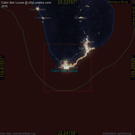
Analysis of Cabo San Lucas night lights 2016
Square area 10x10 km:
 13.1%
13.1%90-99
11.31%80-89
7.14%70-79
15.87%60-69
2.38%50-59
2.18%40-49
2.98%30-39
4.56%20-29
13.89%10-19
23.41%0-9
3.17%Square area 50x50 km:
1.12%90-99
0.89%80-89
0.82%70-79
1.69%60-69
0.31%50-59
0.52%40-49
0.59%30-39
0.77%20-29
1.98%10-19
5.82%0-9
85.49%Clear (daylight) street map image can be seen on geolist.org.
Map coordinates:
23° 32' 13.5" North, 110° 36' 55.8" West
22° 53' 27.2" North, 109° 54' 44.6" West
22° 14' 29.7" North, 109° 12' 33.3" West
Some cities around Cabo San Lucas sort by population:
• La Paz
144.9 km =90 mi,  344°
344°
• San José del Cabo
28.8 km =17.9 mi,  49°
49°
• Colonia del Sol
2.8 km =1.7 mi,  329°
329°
• Ciudad Constitución
297.2 km =184.7 mi,  323°
323°
• Eldorado
304.4 km =189.1 mi,  58°
58°
• Las Palmas
5.9 km =3.7 mi, 328°
• Las Veredas
35.7 km =22.2 mi,  36°
36°
• Todos Santos
69.5 km =43.2 mi, 332°
3985710 (p: 68,463)
Sources (retrieved 2019-11-25):
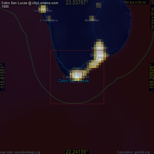
» NASA, Earths city lights 1995
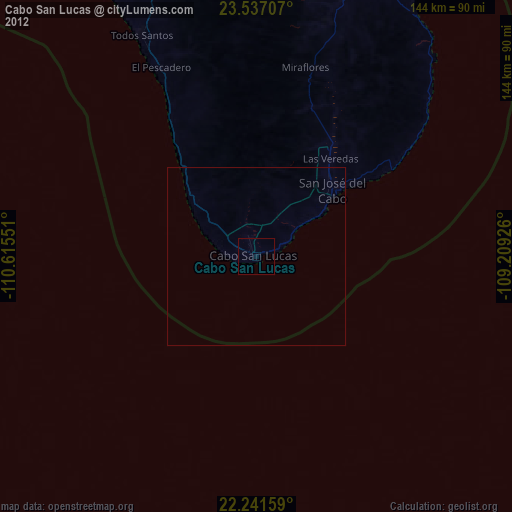
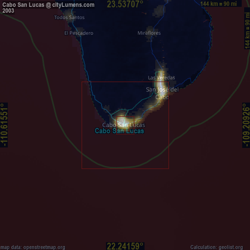
» NASA city lights 2003
» Earth at Night: Flat Maps 2012, 2016