Amozoc de Mota night lights from space
Night Light of Amozoc de Mota (Puebla) from space (Mexico) Src. Average luminocity for 10x10km area is 56.3723% and for 50x50km: 41.7023%.
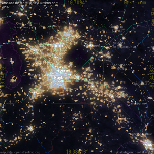
Analysis of Amozoc de Mota night lights 2016
Square area 10x10 km:
 4.55%
4.55%90-99
5.84%80-89
16.23%70-79
8.44%60-69
5.84%50-59
12.34%40-49
15.58%30-39
12.55%20-29
17.32%10-19
1.3%0-9
0%Square area 50x50 km:
8.57%90-99
5.94%80-89
8.66%70-79
6.05%60-69
5.02%50-59
4%40-49
6.57%30-39
6.09%20-29
8.54%10-19
15.04%0-9
25.53%Clear (daylight) street map image can be seen on geolist.org.
Map coordinates:
19° 42' 33.8" North, 98° 44' 53.3" West
19° 2' 46" North, 98° 2' 42" West
18° 22' 48.6" North, 97° 20' 30.8" West
Some cities around Amozoc de Mota sort by population:
• Acajete
12.2 km =7.6 mi,  53°
53°
• Casa Blanca
7.8 km =4.8 mi,  266°
266°
• Tepatlaxco de Hidalgo
8.5 km =5.3 mi,  62°
62°
• Santa María Xonacatepec
7.8 km =4.8 mi,  308°
308°
• La Resurrección
10.9 km =6.8 mi, 305°
• San Juan Tepulco
9.9 km =6.2 mi,  36°
36°
• La Magdalena Tetela Morelos
10.9 km =6.8 mi,  88°
88°
• San Agustín Tlaxco
5.7 km =3.5 mi,  78°
78°
3532881 (p: 77,106)
Sources (retrieved 2019-11-25):
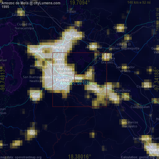
» NASA, Earths city lights 1995
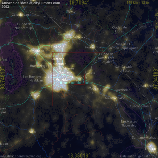
» NASA city lights 2003
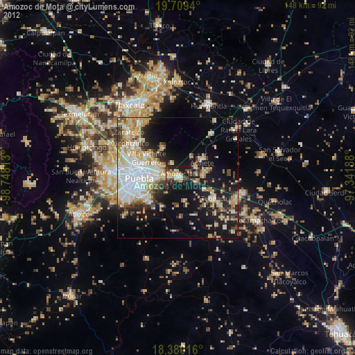
» Earth at Night: Flat Maps 2012, 2016