La Resurrección night lights from space
Night Light of La Resurrección (Puebla) from space (Mexico) Src. Average luminocity for 10x10km area is 80.2922% and for 50x50km: 52.2746%.
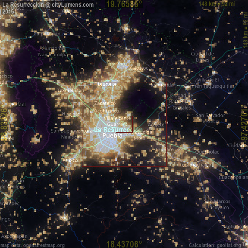
Analysis of La Resurrección night lights 2016
Square area 10x10 km:
 21%
21%90-99
20.56%80-89
21.86%70-79
9.31%60-69
6.49%50-59
9.09%40-49
5.41%30-39
4.33%20-29
1.95%10-19
0%0-9
0%Square area 50x50 km:
9.98%90-99
7.61%80-89
12.76%70-79
9.14%60-69
6.52%50-59
6.74%40-49
7.91%30-39
5.19%20-29
7.6%10-19
12.35%0-9
14.22%Clear (daylight) street map image can be seen on geolist.org.
Map coordinates:
19° 45' 57.1" North, 98° 49' 59.7" West
19° 6' 10" North, 98° 7' 48.5" West
18° 26' 13.4" North, 97° 25' 37.2" West
Some cities around La Resurrección sort by population:
• Villa Vicente Guerrero
4.3 km =2.7 mi,  298°
298°
• Casa Blanca
6.8 km =4.2 mi,  170°
170°
• San Miguel Canoa
6.2 km =3.9 mi,  27°
27°
• Santa María Xonacatepec
3.2 km =2 mi,  118°
118°
• Tenancingo
9 km =5.6 mi, 303°
• Mazatecochco
10.3 km =6.4 mi,  324°
324°
• San Isidro Buen Suceso
6.4 km =4 mi,  24°
24°
• San Sebastián de Aparicio
3.2 km =2 mi,  271°
271°
3520356 (p: 9,065)
Sources (retrieved 2019-11-25):
» Earth at Night: Flat Maps 2012, 2016