Morelia night lights from space
Night Light of Morelia (Michoacán) from space (Mexico) Src. Average luminocity for 10x10km area is 92.1736% and for 50x50km: 16.1967%.
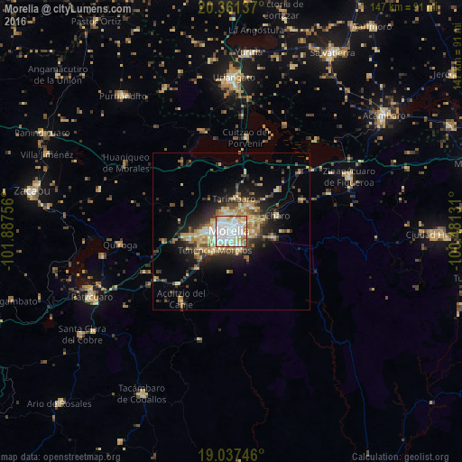

Analysis of Morelia night lights 2016
Square area 10x10 km:
 38.22%
90-99
34.92%80-89
9.92%70-79
9.71%60-69
4.75%50-59
2.07%40-49
0.41%30-39
0%20-29
0%10-19
0%0-9
0%Square area 50x50 km:
1.91%90-99
2.46%80-89
2.97%70-79
2.33%60-69
2.65%50-59
1.39%40-49
2.64%30-39
2.21%20-29
4.35%10-19
7.51%0-9
69.58%Clear (daylight) street map image can be seen on geolist.org.
Map coordinates:
20° 21' 40.9" North, 101° 53' 15.2" West
19° 42' 2.8" North, 101° 11' 3.9" West
19° 2' 14.9" North, 100° 28' 52.7" West
Some cities around Morelia sort by population:
• Conjunto Habitacional Villas del Pedregal
12.6 km =7.8 mi,  261°
261°
• Álvaro Obregón
20.2 km =12.6 mi,  48°
48°
• Fraccionamiento Misión del Valle
9.7 km =6 mi,  42°
42°
• La Aldea
7 km =4.3 mi, 47°
• Tarímbaro
10.6 km =6.6 mi,  3°
3°
• Fraccionamiento Galaxia Tarímbaro
6.9 km =4.3 mi,  351°
351°
• Fraccionamiento Metrópolis II
6.5 km =4 mi,  341°
341°
• Charo
15.5 km =9.6 mi,  69°
69°
3995402 (p: 597,511)
Sources (retrieved 2019-11-25):
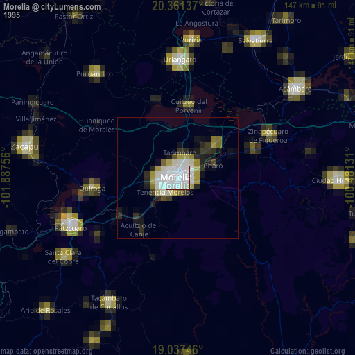
» NASA, Earths city lights 1995
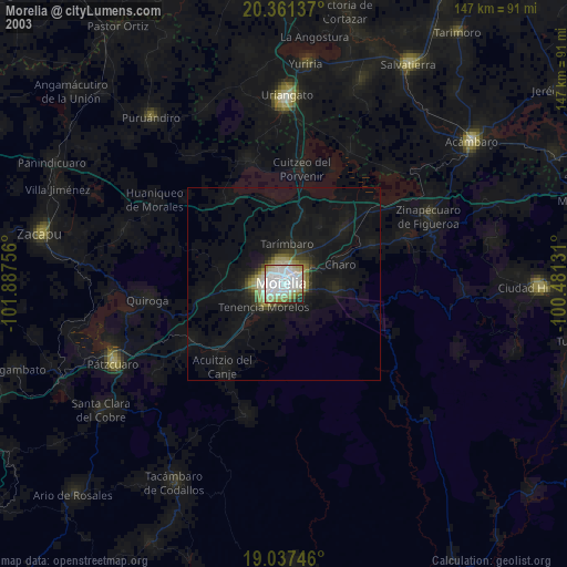
» NASA city lights 2003
» Earth at Night: Flat Maps 2012, 2016