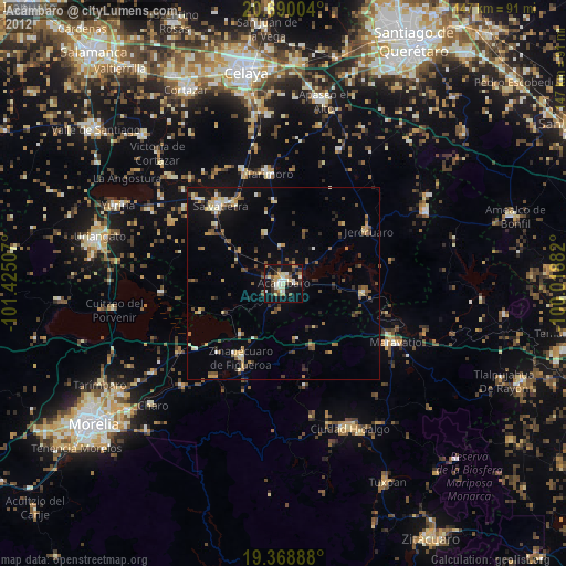
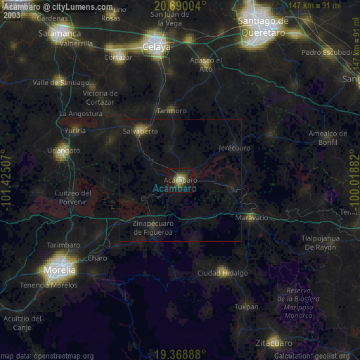
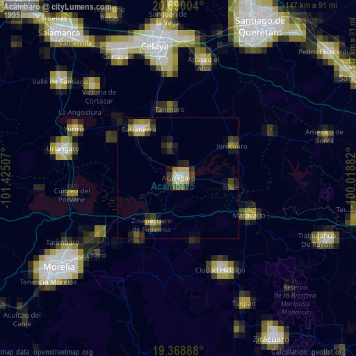
Acámbaro night lights from space
Night Light of Acámbaro (Guanajuato) from space (Mexico) Src. Average luminocity for 10x10km area is 37.1746% and for 50x50km: 9.3027%.
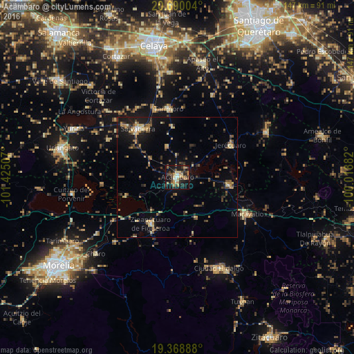
Analysis of Acámbaro night lights 2016
Square area 10x10 km:
 1.19%
1.19%90-99
4.17%80-89
6.55%70-79
7.94%60-69
7.34%50-59
1.39%40-49
8.73%30-39
8.73%20-29
10.12%10-19
36.11%0-9
7.74%Square area 50x50 km:
0.19%90-99
0.52%80-89
1.68%70-79
1.51%60-69
1.12%50-59
1.09%40-49
2.26%30-39
1.5%20-29
2.15%10-19
6.85%0-9
81.13%Clear (daylight) street map image can be seen on geolist.org.
Map coordinates:
20° 41' 24.1" North, 101° 25' 30.3" West
20° 1' 51.1" North, 100° 43' 19" West
19° 22' 8" North, 100° 1' 7.8" West
Some cities around Acámbaro sort by population:
• Salvatierra
26.2 km =16.3 mi,  320°
320°
• Zinapécuaro
22 km =13.7 mi,  210°
210°
• Tarimoro
28.3 km =17.6 mi,  353°
353°
• Estación Queréndaro
28.8 km =17.9 mi,  235°
235°
• Urireo
23.8 km =14.8 mi,  328°
328°
• Jerécuaro
26.2 km =16.3 mi,  58°
58°
• Tarandacuao
21.5 km =13.4 mi,  98°
98°
• Irámuco
22.3 km =13.9 mi,  249°
249°
4019827 (p: 57,972)
Sources (retrieved 2019-11-25):
» NASA, Earths city lights 1995
» NASA city lights 2003
» Earth at Night: Flat Maps 2012, 2016