Terre Rouge night lights from space
Night Light of Terre Rouge (Pamplemousses) from space (Mauritius) Src. Average luminocity for 10x10km area is 56.7877% and for 50x50km: 16.8347%.
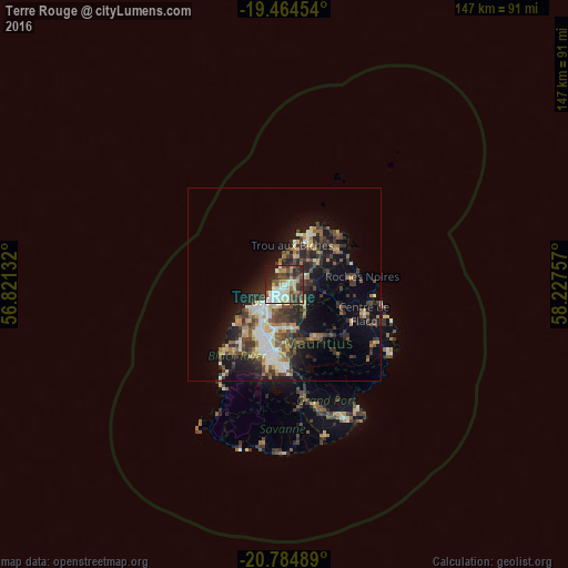
Analysis of Terre Rouge night lights 2016
Square area 10x10 km:
 10.52%
90-99
12.3%80-89
8.53%70-79
5.75%60-69
5.75%50-59
4.76%40-49
16.07%30-39
13.1%20-29
14.09%10-19
8.53%0-9
0.6%Square area 50x50 km:
1.65%90-99
2.96%80-89
2.26%70-79
1.71%60-69
1.97%50-59
2.07%40-49
3.7%30-39
3.88%20-29
5.77%10-19
8.94%0-9
65.09%Clear (daylight) street map image can be seen on geolist.org.
Map coordinates:
19° 27' 52.3" South, 56° 49' 16.8" East
20° 7' 34" South, 57° 31' 28" East
20° 47' 5.6" South, 58° 13' 39.3" East
Some cities around Terre Rouge sort by population:
• Port Louis
4.8 km =3 mi,  213°
213°
• Triolet
8.1 km =5 mi,  19°
19°
• Le Hochet
1 km =0.6 mi,  199°
199°
• Pailles
8.3 km =5.2 mi, 207°
• Pamplemousses
5.4 km =3.4 mi,  62°
62°
• Long Mountain
4.4 km =2.7 mi,  115°
115°
• Pointe aux Piments
6.8 km =4.2 mi,  359°
359°
• Morcellement Saint André
7.6 km =4.7 mi,  37°
37°
933974 (p: 9,566)
Sources (retrieved 2019-11-25):
» Earth at Night: Flat Maps 2012, 2016