Valandovo night lights from space
Night Light of Valandovo from space (North Macedonia) Src. Average luminocity for 10x10km area is 4.8248% and for 50x50km: 2.7673%.
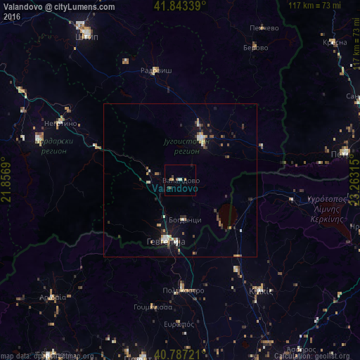
Analysis of Valandovo night lights 2016
Square area 10x10 km:
 0.51%
0.51%90-99
0.85%80-89
0.34%70-79
1.7%60-69
0%50-59
0%40-49
1.7%30-39
1.02%20-29
0%10-19
0.34%0-9
93.54%Square area 50x50 km:
0.2%90-99
0.58%80-89
0.23%70-79
0.32%60-69
0.32%50-59
0.36%40-49
0.27%30-39
0.46%20-29
0.6%10-19
1.59%0-9
95.05%Clear (daylight) street map image can be seen on geolist.org.
Map coordinates:
41° 50' 36.2" North, 21° 51' 24.8" East
41° 19' 2.8" North, 22° 33' 36.1" East
40° 47' 14" North, 23° 15' 47.3" East
Some cities around Valandovo sort by population:
• Strumica
15.1 km =9.4 mi,  27°
27°
• Gevgelija
20.2 km =12.6 mi,  194°
194°
• Bosilovo
19.6 km =12.2 mi,  45°
45°
• Vasilevo
18.7 km =11.6 mi,  21°
21°
• Bogdanci
12.8 km =8 mi,  174°
174°
• Demir Kapija
28 km =17.4 mi,  290°
290°
• Konče
24.6 km =15.3 mi,  323°
323°
• Star Dojran
19.8 km =12.3 mi,  137°
137°
784733 (p: 3,798)
Sources (retrieved 2019-11-25):
» Earth at Night: Flat Maps 2012, 2016