Rosoman night lights from space
Night Light of Rosoman from space (North Macedonia) Src. Average luminocity for 10x10km area is 3.6803% and for 50x50km: 2.2733%.
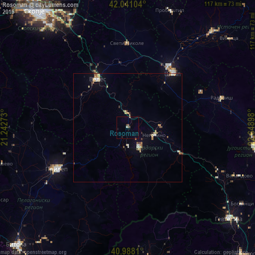
Analysis of Rosoman night lights 2016
Square area 10x10 km:
 0%
0%90-99
0.68%80-89
0.34%70-79
0%60-69
0.51%50-59
0.85%40-49
0.68%30-39
0.68%20-29
0.68%10-19
0.68%0-9
94.9%Square area 50x50 km:
0.12%90-99
0.38%80-89
0.43%70-79
0.33%60-69
0.3%50-59
0.3%40-49
0.23%30-39
0.2%20-29
0.13%10-19
0.72%0-9
96.86%Clear (daylight) street map image can be seen on geolist.org.
Map coordinates:
42° 2' 27.7" North, 21° 14' 33.8" East
41° 31' 0.2" North, 21° 56' 45.1" East
40° 59' 17.2" North, 22° 38' 56.3" East
Some cities around Rosoman sort by population:
• Veles
26.3 km =16.3 mi,  327°
327°
• Shtip
32.9 km =20.4 mi,  39°
39°
• Kavadarci
10.8 km =6.7 mi,  149°
149°
• Negotino
12.6 km =7.8 mi,  106°
106°
• Demir Kapija
27.9 km =17.3 mi,  116°
116°
• Gradsko
6.8 km =4.2 mi,  357°
357°
• Čaška
27.9 km =17.3 mi,  302°
302°
• Lozovo
29.9 km =18.6 mi,  353°
353°
786239 (p: 4,106)
Sources (retrieved 2019-11-25):
» Earth at Night: Flat Maps 2012, 2016