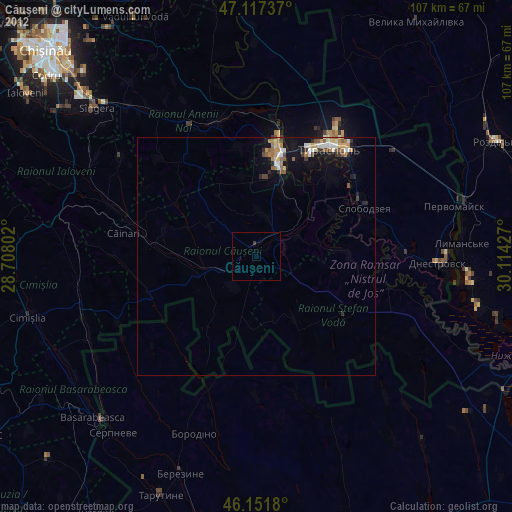
Căuşeni night lights from space
Night Light of Căuşeni from space (Moldova) Src. Average luminocity for 10x10km area is 0.3153% and for 50x50km: 1.4824%.
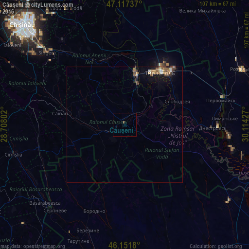
Analysis of Căuşeni night lights 2016
Square area 10x10 km:
 0%
0%90-99
0%80-89
0%70-79
0%60-69
0%50-59
0.57%40-49
0%30-39
0%20-29
0%10-19
0%0-9
99.43%Square area 50x50 km:
0.09%90-99
0.18%80-89
0.15%70-79
0.16%60-69
0.25%50-59
0.39%40-49
0.43%30-39
0.16%20-29
0.13%10-19
0.97%0-9
97.1%Clear (daylight) street map image can be seen on geolist.org.
Map coordinates:
47° 7' 2.5" North, 28° 42' 28.9" East
46° 38' 12.3" North, 29° 24' 40.1" East
46° 9' 6.5" North, 30° 6' 51.4" East
Some cities around Căuşeni sort by population:
• Tiraspol
28.3 km =17.6 mi,  35°
35°
• Bender
22.2 km =13.8 mi,  13°
13°
• Slobozia
24.6 km =15.3 mi,  65°
65°
• Dnestrovsc
38.9 km =24.2 mi,  93°
93°
• Chiţcani
22.6 km =14 mi, 43°
• Lymanske, UA
42.5 km =26.4 mi, 87°
• Anenii Noi
30 km =18.6 mi,  333°
333°
• Ştefan Vodă
23.6 km =14.7 mi,  125°
125°
618120 (p: 21,690)
Sources (retrieved 2019-11-25):
» Earth at Night: Flat Maps 2012, 2016