Mechraa Bel Ksiri night lights from space
Night Light of Mechraa Bel Ksiri (Rabat-Salé-Kénitra) from space (Morocco) Src. Average luminocity for 10x10km area is 10.6101% and for 50x50km: 2.0324%.
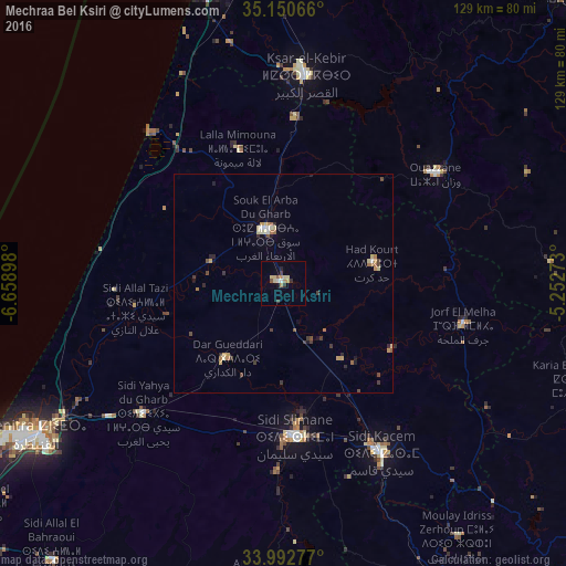

Analysis of Mechraa Bel Ksiri night lights 2016
Square area 10x10 km:
 1.05%
1.05%90-99
0.35%80-89
3.67%70-79
1.05%60-69
1.57%50-59
1.4%40-49
0%30-39
2.27%20-29
1.22%10-19
1.05%0-9
86.36%Square area 50x50 km:
0.11%90-99
0.14%80-89
0.43%70-79
0.36%60-69
0.34%50-59
0.2%40-49
0.26%30-39
0.48%20-29
0.32%10-19
0.28%0-9
97.07%Clear (daylight) street map image can be seen on geolist.org.
Map coordinates:
35° 9' 2.4" North, 6° 39' 32.3" West
34° 34' 25.4" North, 5° 57' 21.1" West
33° 59' 34" North, 5° 15' 9.8" West
Some cities around Mechraa Bel Ksiri sort by population:
• Kenitra
67 km =41.6 mi,  238°
238°
• Larache
71.3 km =44.3 mi,  345°
345°
• Ksar El Kebir
47.7 km =29.6 mi,  5°
5°
• Sidi Slimane
34.5 km =21.4 mi,  175°
175°
• Sidi Qacem
45.3 km =28.1 mi,  149°
149°
• Ouezzane
42.4 km =26.3 mi,  54°
54°
• Souq Larb’a al Gharb
13.3 km =8.3 mi,  341°
341°
• Sidi Yahia El Gharb
43.7 km =27.2 mi,  226°
226°
2542866 (p: 27,802)
Sources (retrieved 2019-11-25):
» Earth at Night: Flat Maps 2012, 2016