Al Aaroui night lights from space
Night Light of Al Aaroui (Oriental) from space (Morocco) Src. Average luminocity for 10x10km area is 26.8636% and for 50x50km: 7.4336%.
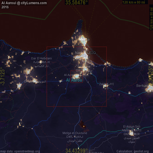
Analysis of Al Aaroui night lights 2016
Square area 10x10 km:
 1.57%
1.57%90-99
4.02%80-89
3.5%70-79
3.85%60-69
5.24%50-59
2.62%40-49
3.67%30-39
5.42%20-29
4.2%10-19
30.59%0-9
35.31%Square area 50x50 km:
0.81%90-99
1.02%80-89
0.62%70-79
0.9%60-69
1.38%50-59
0.76%40-49
1.22%30-39
1.45%20-29
3.34%10-19
5.27%0-9
83.22%Clear (daylight) street map image can be seen on geolist.org.
Map coordinates:
35° 35' 5.1" North, 3° 42' 45" West
35° 0' 39.2" North, 3° 0' 33.8" West
34° 25' 58.8" North, 2° 18' 22.5" West
Some cities around Al Aaroui sort by population:
• Nador
18.8 km =11.7 mi,  21°
21°
• Taourirt
67.9 km =42.2 mi,  171°
171°
• Berkane
63.6 km =39.5 mi,  99°
99°
• Melilla, ES
32.1 km =19.9 mi,  11°
11°
• El Aïoun
66.1 km =41.1 mi,  135°
135°
• Zaïo
26.3 km =16.3 mi,  106°
106°
• Bni Bouayach
76.3 km =47.4 mi,  277°
277°
• Midar
48.4 km =30.1 mi,  260°
260°
2542013 (p: 36,021)
Sources (retrieved 2019-11-25):
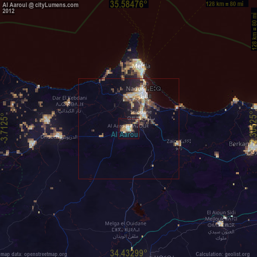
» Earth at Night: Flat Maps 2012, 2016