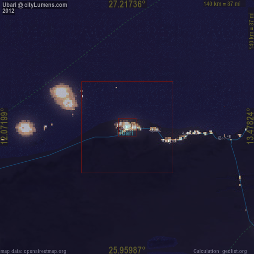
Ubari night lights from space
Night Light of Ubari (Wādī al Ḩayāt) from space (Libya) Src. Average luminocity for 10x10km area is 35.6402% and for 50x50km: 2.7279%.
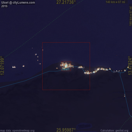
Analysis of Ubari night lights 2016
Square area 10x10 km:
 3.6%
3.6%90-99
5.87%80-89
1.52%70-79
4.73%60-69
11.17%50-59
7.58%40-49
2.46%30-39
4.73%20-29
5.87%10-19
38.45%0-9
14.02%Square area 50x50 km:
0.24%90-99
0.38%80-89
0.06%70-79
0.32%60-69
0.69%50-59
0.63%40-49
0.32%30-39
0.28%20-29
0.35%10-19
2%0-9
94.73%Clear (daylight) street map image can be seen on geolist.org.
Map coordinates:
27° 13' 2.5" North, 12° 4' 19.2" East
26° 35' 25.2" North, 12° 46' 30.4" East
25° 57' 35.5" North, 13° 28' 41.7" East
Some cities around Ubari sort by population:
• Sabhā
171.4 km =106.5 mi,  73°
73°
• Al Jadīd
169.1 km =105.1 mi, 72°
• Murzuq
136.5 km =84.8 mi,  123°
123°
• Brak
182.5 km =113.4 mi,  54°
54°
• Ghat
316.6 km =196.7 mi,  235°
235°
• Hūn
420.4 km =261.2 mi, 47°
• Illizi, DZ
428.7 km =266.4 mi,  268°
268°
• Idrī
99.1 km =61.6 mi,  16°
16°
2219235 (p: 42,975)
Sources (retrieved 2019-11-25):
» Earth at Night: Flat Maps 2012, 2016