Ghat night lights from space
Night Light of Ghat (Ghāt) from space (Libya) Src. Average luminocity for 10x10km area is 20.3655% and for 50x50km: 1.7336%.
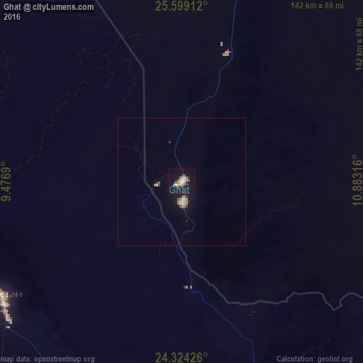
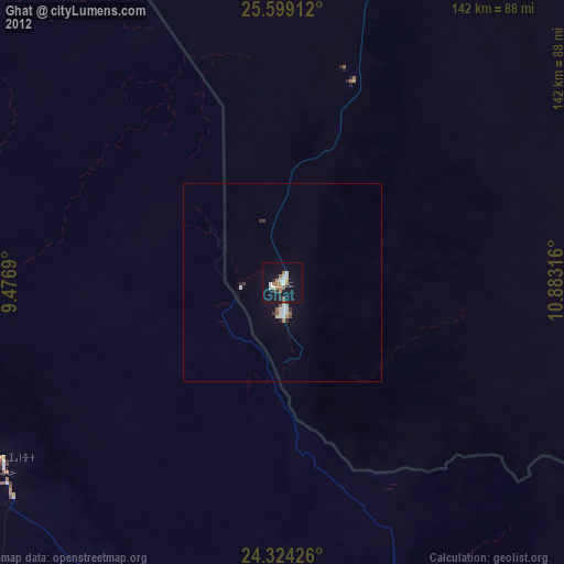
Analysis of Ghat night lights 2016
Square area 10x10 km:
 3.41%
3.41%90-99
2.65%80-89
0%70-79
1.33%60-69
6.25%50-59
1.52%40-49
1.52%30-39
2.65%20-29
2.65%10-19
26.14%0-9
51.89%Square area 50x50 km:
0.27%90-99
0.25%80-89
0%70-79
0.11%60-69
0.51%50-59
0.19%40-49
0.07%30-39
0.26%20-29
0.27%10-19
1.54%0-9
96.54%Clear (daylight) street map image can be seen on geolist.org.
Map coordinates:
25° 35' 56.8" North, 9° 28' 36.8" East
24° 57' 48" North, 10° 10' 48.1" East
24° 19' 27.3" North, 10° 52' 59.4" East
Some cities around Ghat sort by population:
• Sabhā
483.1 km =300.2 mi,  61°
61°
• Al Jadīd
481.3 km =299.1 mi, 61°
• Tamanrasset, DZ
531.8 km =330.4 mi,  242°
242°
• Murzuq
390 km =242.3 mi,  74°
74°
• Ubari
316.6 km =196.7 mi, 55°
• Brak
499.1 km =310.1 mi,  54°
54°
• Illizi, DZ
240.9 km =149.7 mi,  314°
314°
• Idrī
397.9 km =247.2 mi, 46°
2217351 (p: 24,347)
Sources (retrieved 2019-11-25):
» Earth at Night: Flat Maps 2012, 2016