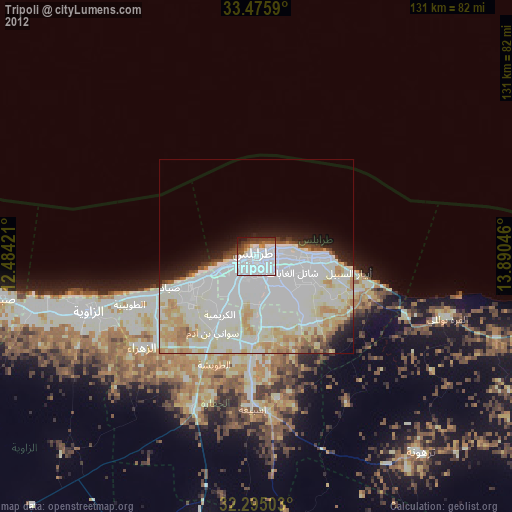
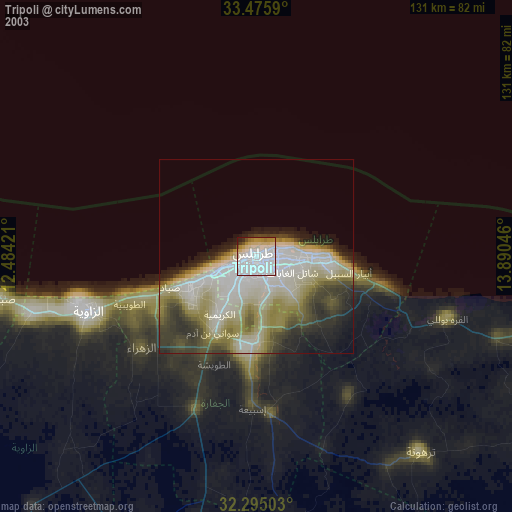
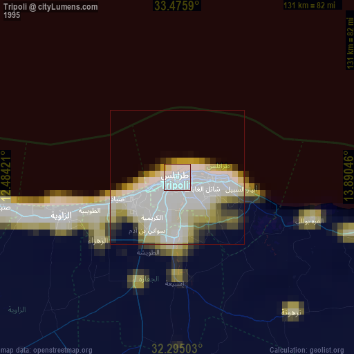
Tripoli night lights from space
Night Light of Tripoli from space (Libya) Src. Average luminocity for 10x10km area is 79.1612% and for 50x50km: 42.9008%.
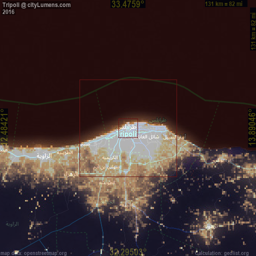
Analysis of Tripoli night lights 2016
Square area 10x10 km:
 50.37%
90-99
16.48%80-89
1.65%70-79
0.73%60-69
2.56%50-59
2.38%40-49
5.86%30-39
5.31%20-29
11.36%10-19
3.3%0-9
0%Square area 50x50 km:
13.24%90-99
9.15%80-89
8.92%70-79
7.56%60-69
4.16%50-59
2.83%40-49
2.46%30-39
1.74%20-29
3.45%10-19
4.14%0-9
42.36%Clear (daylight) street map image can be seen on geolist.org.
Map coordinates:
33° 28' 33.2" North, 12° 29' 3.2" East
32° 53' 14.7" North, 13° 11' 14.4" East
32° 17' 42.1" North, 13° 53' 25.7" East
Some cities around Tripoli sort by population:
• Tarhuna
65.4 km =40.6 mi,  140°
140°
• Az Zāwīyah
45.3 km =28.1 mi,  251°
251°
• Zawiya
45.5 km =28.3 mi, 250°
• Al Ajaylat
77.2 km =48 mi,  259°
259°
• Şabrātah
66.1 km =41.1 mi, 260°
• Tagiura
15.3 km =9.5 mi,  92°
92°
• Şurmān
59.3 km =36.8 mi, 255°
• Al ‘Azīzīyah
42.6 km =26.5 mi,  201°
201°
2210247 (p: 1,150,989)
Sources (retrieved 2019-11-25):
» NASA, Earths city lights 1995
» NASA city lights 2003
» Earth at Night: Flat Maps 2012, 2016