Kurunegala night lights from space
Night Light of Kurunegala (North Western) from space (Sri Lanka) Src. Average luminocity for 10x10km area is 23.0195% and for 50x50km: 1.4931%.

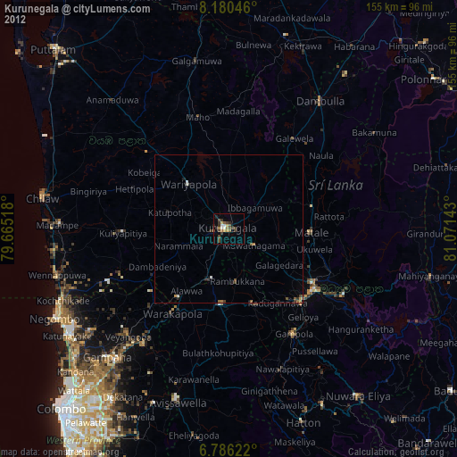
Analysis of Kurunegala night lights 2016
Square area 10x10 km:
 1.3%
1.3%90-99
6.28%80-89
3.9%70-79
2.38%60-69
1.52%50-59
3.03%40-49
1.95%30-39
2.81%20-29
4.55%10-19
15.37%0-9
56.93%Square area 50x50 km:
0.05%90-99
0.24%80-89
0.23%70-79
0.14%60-69
0.1%50-59
0.19%40-49
0.19%30-39
0.38%20-29
0.52%10-19
0.85%0-9
97.11%Clear (daylight) street map image can be seen on geolist.org.
Map coordinates:
8° 10' 49.7" North, 79° 39' 54.6" East
7° 29' 2" North, 80° 22' 5.9" East
6° 47' 10.4" North, 81° 4' 17.1" East
Some cities around Kurunegala sort by population:
• Kandy
36.3 km =22.6 mi,  126°
126°
• Dambulla
52.2 km =32.4 mi,  36°
36°
• Matale
28 km =17.4 mi,  93°
93°
• Gampola
41.9 km =26 mi,  148°
148°
• Kegalle
25.9 km =16.1 mi,  186°
186°
• Gampaha
60.3 km =37.5 mi,  223°
223°
• Minuwangoda
57.8 km =35.9 mi,  232°
232°
• Kuliyapitiya
36.2 km =22.5 mi,  267°
267°
1237980 (p: 28,571)
Sources (retrieved 2019-11-25):
» Earth at Night: Flat Maps 2012, 2016