Hanwella Ihala night lights from space
Night Light of Hanwella Ihala (Western) from space (Sri Lanka) Src. Average luminocity for 10x10km area is 15.8896% and for 50x50km: 25.2002%.
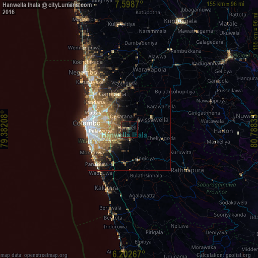
Analysis of Hanwella Ihala night lights 2016
Square area 10x10 km:
 0%
0%90-99
0%80-89
0%70-79
0.87%60-69
1.08%50-59
4.11%40-49
3.25%30-39
9.09%20-29
12.77%10-19
22.29%0-9
46.54%Square area 50x50 km:
3.71%90-99
4.41%80-89
3.63%70-79
4.27%60-69
5.09%50-59
4.61%40-49
4.02%30-39
3.1%20-29
3.92%10-19
6.22%0-9
57.02%Clear (daylight) street map image can be seen on geolist.org.
Map coordinates:
7° 35' 55.3" North, 79° 22' 55.5" East
6° 54' 4.3" North, 80° 5' 6.7" East
6° 12' 9.6" North, 80° 47' 18" East
Some cities around Hanwella Ihala sort by population:
• Pita Kotte
20.3 km =12.6 mi,  266°
266°
• Sri Jayewardenepura Kotte
19.8 km =12.3 mi,  264°
264°
• Battaramulla South
18.5 km =11.5 mi, 268°
• Maharagama
18.5 km =11.5 mi,  251°
251°
• Kotikawatta
19.6 km =12.2 mi,  278°
278°
• Homagama
11.1 km =6.9 mi,  235°
235°
• Mulleriyawa
17.5 km =10.9 mi, 281°
• Kelaniya
19 km =11.8 mi,  288°
288°
1244773 (p: 22,918)
Sources (retrieved 2019-11-25):
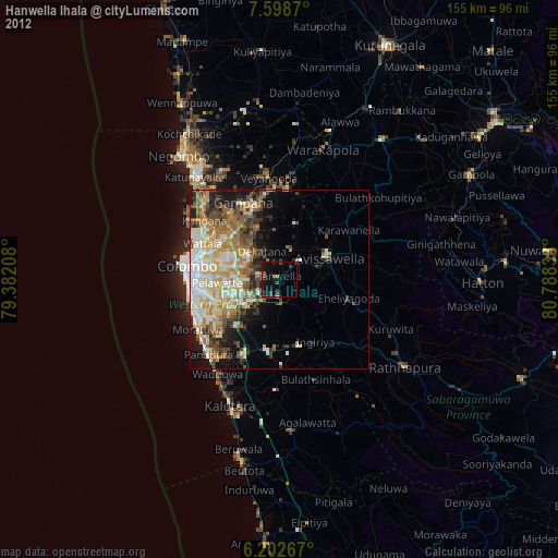
» Earth at Night: Flat Maps 2012, 2016