Balzers night lights from space
Night Light of Balzers from space (Liechtenstein) Src. Average luminocity for 10x10km area is 9.3438% and for 50x50km: 3.8064%.
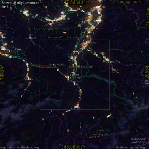
Analysis of Balzers night lights 2016
Square area 10x10 km:
100  0.28%
0.28%
90-99 0.71%
80-89 0.71%
70-79 1.56%
60-69 1.7%
50-59 1.28%
40-49 1.85%
30-39 1.56%
20-29 0.71%
10-19 1.85%
0-9 87.78%
0.28%90-99
0.71%80-89
0.71%70-79
1.56%60-69
1.7%50-59
1.28%40-49
1.85%30-39
1.56%20-29
0.71%10-19
1.85%0-9
87.78%Square area 50x50 km:
100 0.22%
90-99 0.45%
80-89 0.26%
70-79 0.66%
60-69 0.62%
50-59 0.58%
40-49 0.73%
30-39 0.6%
20-29 0.58%
10-19 2.13%
0-9 93.17%
0.22%90-99
0.45%80-89
0.26%70-79
0.66%60-69
0.62%50-59
0.58%40-49
0.73%30-39
0.6%20-29
0.58%10-19
2.13%0-9
93.17%Clear (daylight) street map image can be seen on geolist.org.
Map coordinates:
47° 32' 36.3" North, 8° 47' 57.8" East
47° 3' 59.9" North, 9° 30' 9" East
46° 35' 8.1" North, 10° 12' 20.3" East
Some cities around Balzers sort by population:
• Buchs, CH
11.4 km =7.1 mi,  350°
350°
• Schaan
10.9 km =6.8 mi,  2°
2°
• Vaduz
8.4 km =5.2 mi,  9°
9°
• Bad Ragaz, CH
6.7 km =4.2 mi,  179°
179°
• Sargans, CH
5.1 km =3.2 mi,  247°
247°
• Triesen
4.9 km =3 mi,  23°
23°
• Triesenberg
6.5 km =4 mi,  27°
27°
• Planken
13.6 km =8.5 mi, 13°
3042073 (p: 4,447)
Sources (retrieved 2019-11-25):
» Earth at Night: Flat Maps 2012, 2016