Triesenberg night lights from space
Night Light of Triesenberg from space (Liechtenstein) Src. Average luminocity for 10x10km area is 11.348% and for 50x50km: 4.1498%.
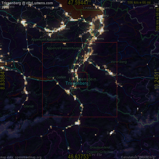
Analysis of Triesenberg night lights 2016
Square area 10x10 km:
 0.14%
0.14%90-99
1.42%80-89
0.71%70-79
1.7%60-69
3.27%50-59
0.28%40-49
2.7%30-39
2.27%20-29
1.7%10-19
9.94%0-9
75.85%Square area 50x50 km:
0.15%90-99
0.41%80-89
0.26%70-79
0.67%60-69
0.7%50-59
0.67%40-49
0.89%30-39
0.79%20-29
0.74%10-19
3.14%0-9
91.57%Clear (daylight) street map image can be seen on geolist.org.
Map coordinates:
47° 35' 40.1" North, 8° 50' 19.8" East
47° 7' 5.3" North, 9° 32' 31.1" East
46° 38' 15.1" North, 10° 14' 42.4" East
Some cities around Triesenberg sort by population:
• Buchs, CH
7.3 km =4.5 mi,  318°
318°
• Grabs, CH
10.3 km =6.4 mi,  313°
313°
• Schaan
5.8 km =3.6 mi,  334°
334°
• Vaduz
3 km =1.9 mi, 329°
• Sargans, CH
10.8 km =6.7 mi,  224°
224°
• Balzers
6.5 km =4 mi,  207°
207°
• Eschen
10.4 km =6.5 mi,  351°
351°
• Planken
7.5 km =4.7 mi,  1°
1°
3042033 (p: 2,689)
Sources (retrieved 2019-11-25):
» Earth at Night: Flat Maps 2012, 2016