Bad Ragaz night lights from space
Night Light of Bad Ragaz (Saint Gallen) from space (Switzerland) Src. Average luminocity for 10x10km area is 9.6506% and for 50x50km: 3.3593%.
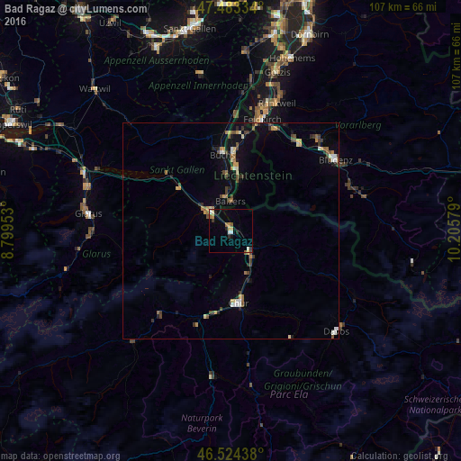
Analysis of Bad Ragaz night lights 2016
Square area 10x10 km:
 0.85%
0.85%90-99
1.7%80-89
0.85%70-79
2.13%60-69
1.28%50-59
0.57%40-49
0.85%30-39
1.42%20-29
1.56%10-19
0.99%0-9
87.78%Square area 50x50 km:
0.22%90-99
0.47%80-89
0.29%70-79
0.52%60-69
0.47%50-59
0.38%40-49
0.64%30-39
0.59%20-29
0.56%10-19
1.4%0-9
94.45%Clear (daylight) street map image can be seen on geolist.org.
Map coordinates:
47° 29' 0" North, 8° 47' 58.3" East
47° 0' 21.6" North, 9° 30' 9.6" East
46° 31' 27.8" North, 10° 12' 20.8" East
Some cities around Bad Ragaz sort by population:
• Chur
17.5 km =10.9 mi,  172°
172°
• Igis
8.6 km =5.3 mi,  141°
141°
• Schaan, LI
17.7 km =11 mi,  1°
1°
• Vaduz, LI
15.1 km =9.4 mi,  5°
5°
• Sargans
6.7 km =4.2 mi,  315°
315°
• Triesen, LI
11.5 km =7.1 mi, 9°
• Balzers, LI
6.7 km =4.2 mi,  359°
359°
• Triesenberg, LI
12.8 km =8 mi, 13°
2661644 (p: 5,063)
Sources (retrieved 2019-11-25):
» Earth at Night: Flat Maps 2012, 2016