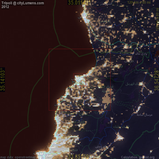
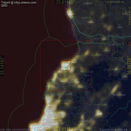
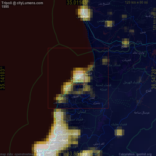
Tripoli night lights from space
Night Light of Tripoli (Liban-Nord) from space (Lebanon) Src. Average luminocity for 10x10km area is 68.6469% and for 50x50km: 27.0315%.
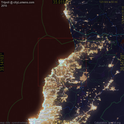
Analysis of Tripoli night lights 2016
Square area 10x10 km:
 14.34%
90-99
13.81%80-89
25.7%70-79
9.09%60-69
5.77%50-59
2.45%40-49
2.8%30-39
5.42%20-29
14.16%10-19
6.12%0-9
0.35%Square area 50x50 km:
0.98%90-99
2.2%80-89
7.41%70-79
4.08%60-69
4.8%50-59
5.99%40-49
6.64%30-39
4.52%20-29
6.46%10-19
12.49%0-9
44.44%Clear (daylight) street map image can be seen on geolist.org.
Map coordinates:
35° 0' 41.1" North, 35° 8' 27.7" East
34° 26' 0.7" North, 35° 50' 38.9" East
33° 51' 5.7" North, 36° 32' 50.2" East
Some cities around Tripoli sort by population:
• Jounieh
54.5 km =33.9 mi,  202°
202°
• Tartouss, SY
50.8 km =31.6 mi,  4°
4°
• Tallkalakh, SY
46.2 km =28.7 mi,  55°
55°
• Satita, SY
49.8 km =30.9 mi,  30°
30°
• Jbaïl
39.1 km =24.3 mi,  207°
207°
• Bcharré
25.4 km =15.8 mi,  143°
143°
• Batroûn
26.2 km =16.3 mi,  220°
220°
• Halba
24.8 km =15.4 mi, 60°
266826 (p: 229,398)
Sources (retrieved 2019-11-25):
» NASA, Earths city lights 1995
» NASA city lights 2003
» Earth at Night: Flat Maps 2012, 2016