Terenozek night lights from space
Night Light of Terenozek (Qyzylorda) from space (Kazakhstan) Src. Average luminocity for 10x10km area is 5.1152% and for 50x50km: 0.4896%.
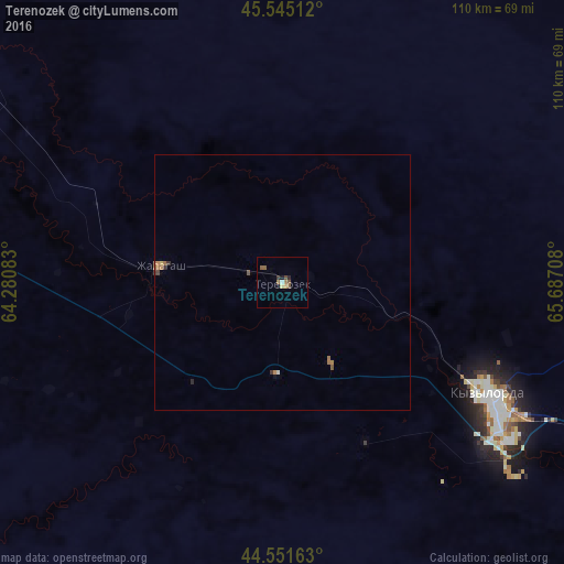
Analysis of Terenozek night lights 2016
Square area 10x10 km:
 0.3%
0.3%90-99
0.3%80-89
0.61%70-79
0.61%60-69
1.06%50-59
2.27%40-49
0.91%30-39
0.45%20-29
0.76%10-19
1.21%0-9
91.52%Square area 50x50 km:
0.01%90-99
0.04%80-89
0.05%70-79
0.05%60-69
0.21%50-59
0.15%40-49
0.09%30-39
0.08%20-29
0.08%10-19
0.07%0-9
99.18%Clear (daylight) street map image can be seen on geolist.org.
Map coordinates:
45° 32' 42.4" North, 64° 16' 51" East
45° 3' 1.9" North, 64° 59' 2.2" East
44° 33' 5.9" North, 65° 41' 13.5" East
Some cities around Terenozek sort by population:
• Kyzylorda
46.8 km =29.1 mi,  118°
118°
• Baikonur
144.7 km =89.9 mi,  295°
295°
• Shīeli
170 km =105.6 mi,  125°
125°
• Yanykurgan
220 km =136.7 mi, 125°
• Zhosaly
86 km =53.4 mi, 304°
• Tasböget
54.3 km =33.7 mi, 124°
• Dzhalagash
25.2 km =15.7 mi,  278°
278°
• Tyuratam
146.7 km =91.2 mi, 297°
1518203 (p: 9,661)
Sources (retrieved 2019-11-25):
» Earth at Night: Flat Maps 2012, 2016